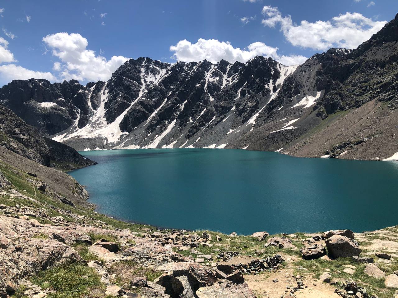
Lakes of Kyrgyzstan: Geography, Major Lakes and Alpine Lake Systems
Introduction: Why Kyrgyzstan Is a Country of Mountain Lakes
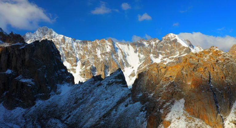
Kyrgyzstan is one of the most mountainous countries in the world. Nearly ninety percent of its territory consists of mountain terrain shaped by the Tian Shan and Pamir-Alay systems. This rugged relief, together with widespread glaciation, enclosed intermontane basins, and active geological processes, created one of the most distinctive lake landscapes in Central Asia.
Although the country is most often associated with Issyk-Kul, the lake geography of Kyrgyzstan is far broader and more complex. The national lake system includes around 1,900 lakes, ranging from vast tectonic basins to small alpine and glacial lakes hidden among high ridges and remote valleys. Some occupy deep structural depressions formed by tectonic movements, while others originated through glacial retreat, moraine damming, or landslides that blocked mountain rivers.
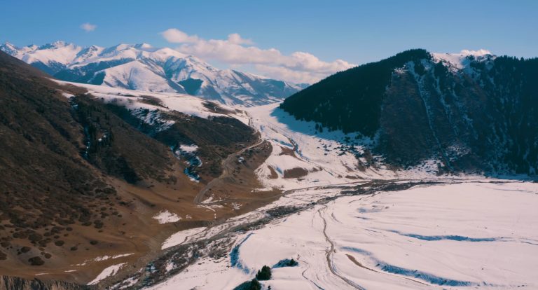
This combination of lake types makes Kyrgyzstan unusual. A small number of large lakes account for most of the total water surface, while the overwhelming majority are small mountain lakes scattered across high-altitude terrain. Many of them lie above 3,000 meters above sea level and remain frozen for much of the year. In the highest parts of the Tian Shan, glacial and moraine-dammed lakes often occur in clusters, especially in valleys shaped by former or modern glaciers.
In physical-geographic terms, the lakes of Kyrgyzstan can be divided into several broad categories. The first includes large tectonic lakes occupying major mountain depressions. Issyk-Kul, Son-Kul, and Chatyr-Kul belong to this group and dominate the country’s lake geography in terms of surface area. A second group includes glacial and moraine-dammed lakes, which are especially common in the high mountain belts of the Tian Shan. A third category consists of landslide-dammed lakes created when rockfalls or slope collapse blocked river valleys and trapped water behind natural barriers.
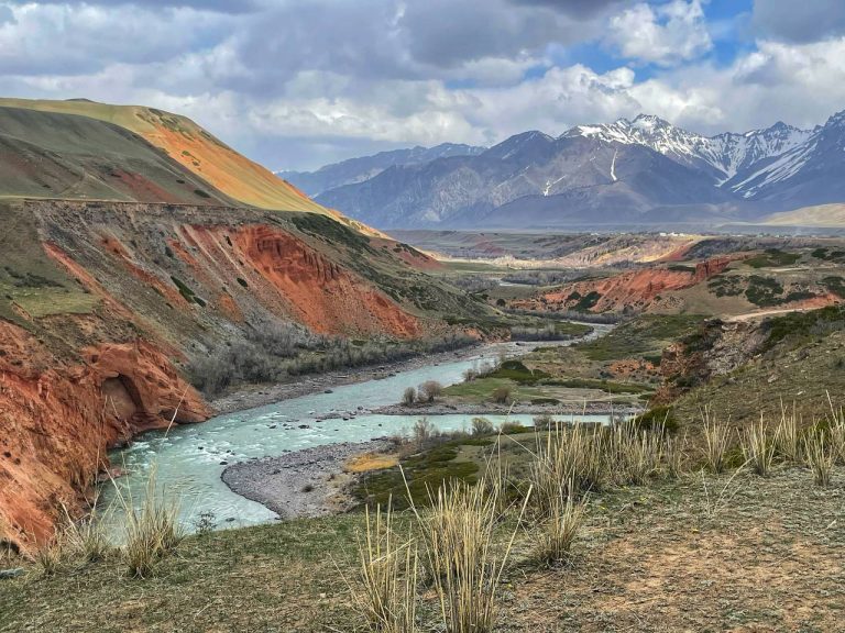
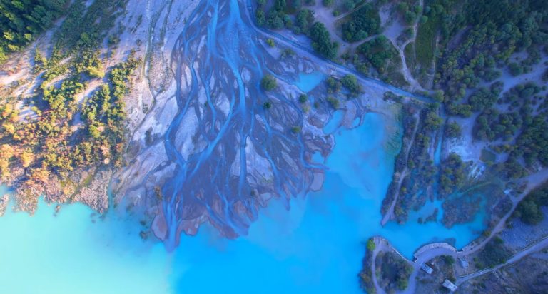
Elevation is one of the key factors controlling this distribution. Lower basins contain only a few large permanent lakes, whereas much of the high-mountain zone is dotted with small alpine and glacial lakes formed by snowmelt, glacier activity, and enclosed terrain. As a result, Kyrgyzstan’s lake geography is inseparable from its mountain hydrology. Lakes, glaciers, rivers, and seasonal meltwater together form a connected water system that supports both local ecosystems and major downstream river networks across Central Asia.
Understanding the lakes of Kyrgyzstan therefore means looking beyond famous destinations and seeing them as part of a larger mountain landscape shaped by geology, climate, and high-altitude hydrology. The sections below examine how many lakes exist in Kyrgyzstan, which are the largest, how different lake types form, and how lake clusters are distributed across the mountain ranges of the Tian Shan and Pamir-Alay.
How Many Lakes Are in Kyrgyzstan?
A widely cited official statistical figure gives 1,923 lakes with a combined surface area of about 6,836 km². Kyrgyzstan Lakes Dataset keeps this as a legacy national statistic rather than treating it as a timeless inventory total, because the original summary does not state a modern remote-sensing minimum-size threshold.
Lake counts depend strongly on what is being counted. A separate 2024 satellite inventory identified 2,592 glacial lakes covering about 77.6 km² under that study’s Sentinel-2 mapping definition. The two figures are not contradictory: one is an older all-lakes national statistic, while the other is a modern inventory of glacial lakes using an explicit remote-sensing methodology and mapping threshold.
Most individual lakes are small mountain or glacial water bodies rather than major basins like Issyk-Kul. Many are only a few hectares in size, and some are seasonal or short-lived. This is why a single national lake count should always be read together with its definition, date, and minimum mapping size.
Taken together, the lakes of Kyrgyzstan cover roughly 6,800 square kilometers of water surface. However, that figure is heavily dominated by Issyk-Kul alone. Once the area of Issyk-Kul is removed, the rest of the national lake system consists mostly of relatively small lakes located at medium or high elevations.
Despite the large number of lakes, the overwhelming majority of lake water is concentrated in a single basin. Hydrological estimates show that more than 99% of the total lake water volume of Kyrgyzstan is contained in Issyk-Kul alone, making it the dominant feature of the national lake system.
Key Hydrological Facts
Lakes form only one part of Kyrgyzstan’s broader water geography. The country also contains thousands of rivers and streams, major glacier systems, and important underground water reserves. Together these resources make Kyrgyzstan one of the key freshwater source regions of Central Asia.
| Indicator | Approximate Value |
|---|---|
| Total lakes | 1,923 |
| Total lake surface area | ~6,836 km² |
| Rivers and streams | 3,500+ |
| Underground water deposits | 44 |
| Total lake water volume | ~1,745 km³ |
| Share of water in Issyk-Kul | ~99% |
| Glaciers | ~9,900 |
Because of its glaciers, rivers, and high mountain lakes, Kyrgyzstan functions as an important water source for Central Asia. Many rivers originating in the Tian Shan mountains contribute to major regional systems such as the Syr Darya basin.
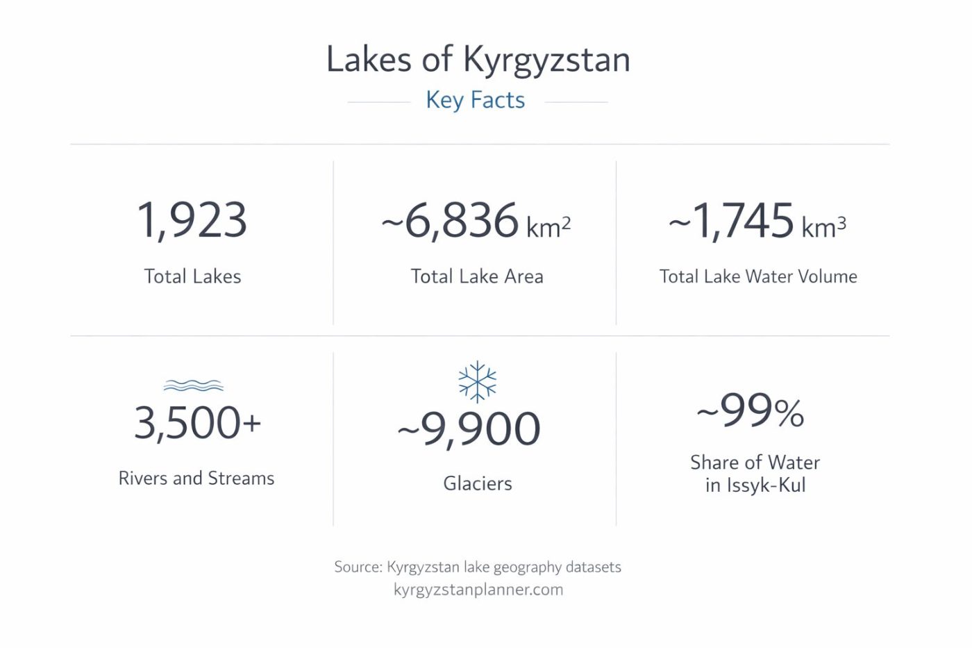
These figures show why Kyrgyzstan is often described not only as a mountain country, but also as a major water-storage region for Central Asia. Snowfields and glaciers feed rivers and lakes, while large basins such as Issyk-Kul and Son-Kul act as important natural reservoirs within the wider mountain hydrological system.
Why Most Lakes Are Small
One of the main characteristics of Kyrgyzstan’s lake system is the small average size of most lakes. Only a limited number of lakes exceed one square kilometer in area, while the rest are much smaller alpine basins formed under mountain conditions.
Hydrological inventories show that only a small fraction of Kyrgyzstan’s lakes exceed one square kilometer in area. The vast majority are small alpine lakes formed in glacial or mountain basins.
There are several reasons for this pattern:
- Glacial erosion: retreating glaciers often leave behind small basins that later fill with meltwater.
- Steep relief: narrow valleys restrict the formation of large open basins.
- Active mountain processes: landslides, rockfalls, and debris dams frequently create irregular lakes of limited size.
- High-altitude climate: some lakes are seasonal or remain ice-covered for long periods.
As a result, Kyrgyzstan’s lake geography is shaped by contrast. The country has only a few dominant large lakes, but also an exceptionally dense network of small high-altitude lakes. That combination is one of the defining features of its physical geography.
It is also worth noting that totals can vary substantially from one source to another. Inventories may differ by date, minimum mapping unit, whether temporary or seasonal basins are counted, and whether the study covers all lakes or only glacial lakes. Kyrgyzstan Lakes Dataset therefore stores national and regional inventory statistics as separate records instead of merging them into one headline number.
Statistical figures are based primarily on official publications of the
National Statistical Committee of the Kyrgyz Republic and regional water resource reports.
The Largest Lakes of Kyrgyzstan
Although Kyrgyzstan has nearly two thousand lakes, only a handful are truly large. In terms of surface area, the national lake system is dominated by a very small number of major basins, above all Issyk-Kul. Most other lakes are relatively small and are better understood as alpine, glacial, or regional mountain lakes rather than as major inland water bodies.
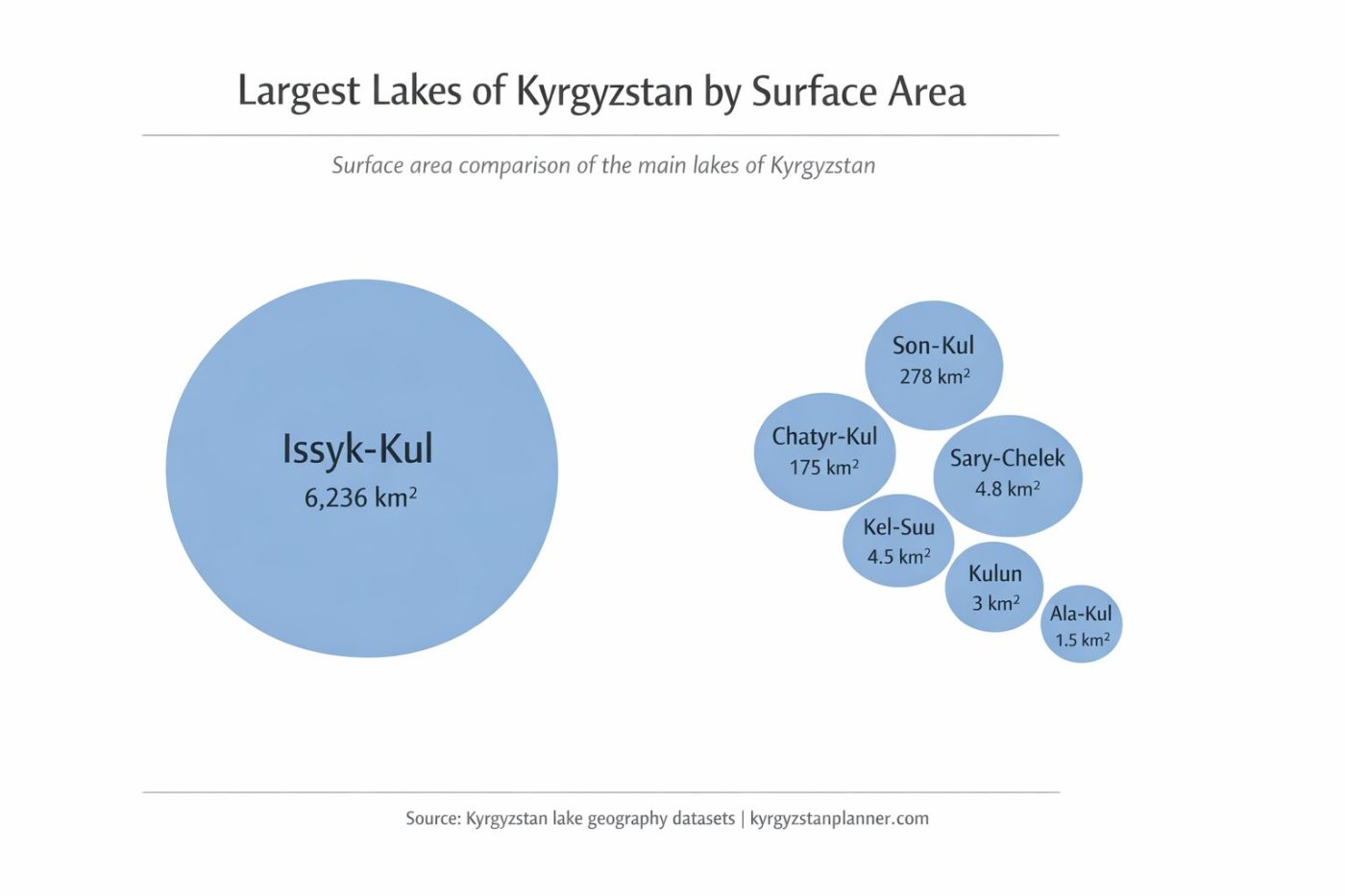
The three largest lakes — Issyk-Kul, Son-Kul, and Chatyr-Kul — form the core of Kyrgyzstan’s lake geography. Together they account for most of the country’s total lake area. Beyond them lies a second group of smaller but geographically notable mountain lakes, including glacial, landslide-dammed, and seasonal alpine lakes found across the Tian Shan and Pamir-Alay.
Largest Lakes of Kyrgyzstan
| Lake | Area (km²) | Elevation (m) | Maximum Depth (m) | Type | Region |
|---|---|---|---|---|---|
| Issyk-Kul | 6,236 | 1,606 | 668 | Tectonic / endorheic | Issyk-Kul Basin |
| Son-Kul | 275 | 3,015.2 | 13.2 | High-altitude tectonic basin | Naryn Region |
| Chatyr-Kul | 175 | 3,530 | 16.6 | High-altitude basin lake | At-Bashy Region |
| Sary-Chelek | ~4.9 | 1,874 | Disputed; no single Kyrgyzstan Lakes Dataset reference value | Landslide-dammed | Chatkal Mountains |
| Kel-Suu | Strongly variable; 4.5 km² is an undated nominal figure | 3,514 | Not established in Kyrgyzstan Lakes Dataset | High-altitude variable lake | Kok-Kiya Valley |
| Kulun | 3.25 | 2,856 | 91 | Landslide-dammed | Kulun-Ata / Kara-Kulja |
| Ala-Kul | 1.6 | 3,560 | Withheld: conflicting published values | Rock-dammed proglacial | Terskey Ala-Too |
| Kol-Ukok | 1.6 | 3,048 | 17 | Mountain lake | Naryn Region |
Beyond the main large basins, Kyrgyzstan also contains many smaller lakes that are important for mountain geography, glaciology, biodiversity, and tourism. While they are modest in size, several are among the country’s most recognizable alpine landscapes.
Notable Alpine and Mountain Lakes
| Lake | Approximate Area (km²) | Elevation (m) | Type | Why It Stands Out | Region |
|---|---|---|---|---|---|
| Ala-Kul | 1.6 | 3,560 | Rock-dammed proglacial | One of the best-known trekking lakes in Kyrgyzstan | Terskey Ala-Too |
| Kol-Ukok | 1.6 | 3,048 | Mountain lake | High-altitude lake in a broad mountain pasture landscape | Naryn Region |
| Tulpar-Kol | ~1 | ~3,500 | Glacial | Scenic lake below Lenin Peak in the Pamir-Alay | Trans-Alay |
| Petrov Lake | 3.9 | 3,741 | Moraine-dammed glacial lake | Important for glacier and hydrology studies | Ak-Shyyrak Massif |
| Merzbacher Lake | Seasonal, variable | ~3,300 | Ice-dammed | Fills and drains periodically; major glaciological site | Central Tian Shan |
| Kel-Suu | Strongly variable | 3,514 | High-altitude variable lake | Dramatic cliff-sided setting in a remote high valley | Kok-Kiya Valley |
| Sary-Chelek | ~4.9 | 1,874 | Landslide-dammed | Deep forest lake within a biosphere reserve | Chatkal Mountains |
| Kulun | 3.25 | 2,856 | Landslide-dammed | One of the best-known mountain lakes of southern Kyrgyzstan | Fergana Range / Kara-Kulja |
Issyk-Kul: The Dominant Lake Basin
The central feature of Kyrgyzstan’s lake geography is Issyk-Kul. With a surface area of more than 6,200 square kilometers, it is by far the largest lake in the country and one of the largest high-altitude lakes in the world. It occupies a vast tectonic basin between the Kungey Ala-Too and Terskey Ala-Too ranges and contains the overwhelming majority of Kyrgyzstan’s total lake water surface.
Issyk-Kul is also unusual because it rarely freezes, despite its elevation and continental setting. Its great depth, slight salinity, and local hydrothermal influences help moderate winter ice formation. This is why the lake is traditionally known as the “Warm Lake.” For practical access, see our guide to getting from Bishkek to Issyk-Kul. Travelers comparing longer lake itineraries can also review our 1–3 day Issyk-Kul route options.
Son-Kul: The Great Lake of the High Plateau
The second largest lake, Son-Kul, lies on a high plateau in the Naryn region at an elevation of just over 3,000 meters above sea level. Unlike Issyk-Kul, it is shallow, strongly seasonal in character, and freezes during winter. In summer the surrounding basin becomes one of the best-known jailoo landscapes in Kyrgyzstan, with broad alpine pastures used for seasonal livestock grazing. For practical access, see our guide to getting from Bishkek to Song-Kul. For travelers comparing organized itineraries, see the main 2- and 3-day Song-Kul options.
Chatyr-Kul: A Remote High-Mountain Basin
The third largest lake, Chatyr-Kul, lies in a remote basin near the Chinese border at an elevation of about 3,530 meters. It is one of the highest large lakes in Central Asia and represents a very different landscape from Issyk-Kul: cold, open, windswept, and semi-arid. Its isolation and altitude make it especially important as a wetland and wildlife habitat within the Inner Tian Shan.
Notable Medium-Sized and Alpine Lakes
Beyond the three dominant basins, Kyrgyzstan has a second group of smaller but well-known mountain lakes. These include Sary-Chelek, famous for its depth and forested setting in the western Tian Shan; Kel-Suu, known for its dramatic high-mountain scenery; and a number of glacial lakes such as Ala-Kul, Kol-Ukok, and Petrov Lake.
These lakes are not large in national hydrological terms, but they are geographically important because they illustrate the diversity of lake-forming processes in Kyrgyzstan. Some were shaped by glacial erosion, some by moraine dams, and others by landslides or enclosed alpine basins. Together they show that the country’s lake geography cannot be understood through Issyk-Kul alone. Because Kel-Suu is unusually remote, travelers planning the journey can compare organized access options for Kel-Suu.
Types of Lakes in Kyrgyzstan
The lakes of Kyrgyzstan were not formed by a single geological process. Instead, the diversity of lake types reflects the complex geological evolution of the Tian Shan mountains. Tectonic uplift, glacier activity, landslides, and erosion have all contributed to the creation of lake basins across the country.
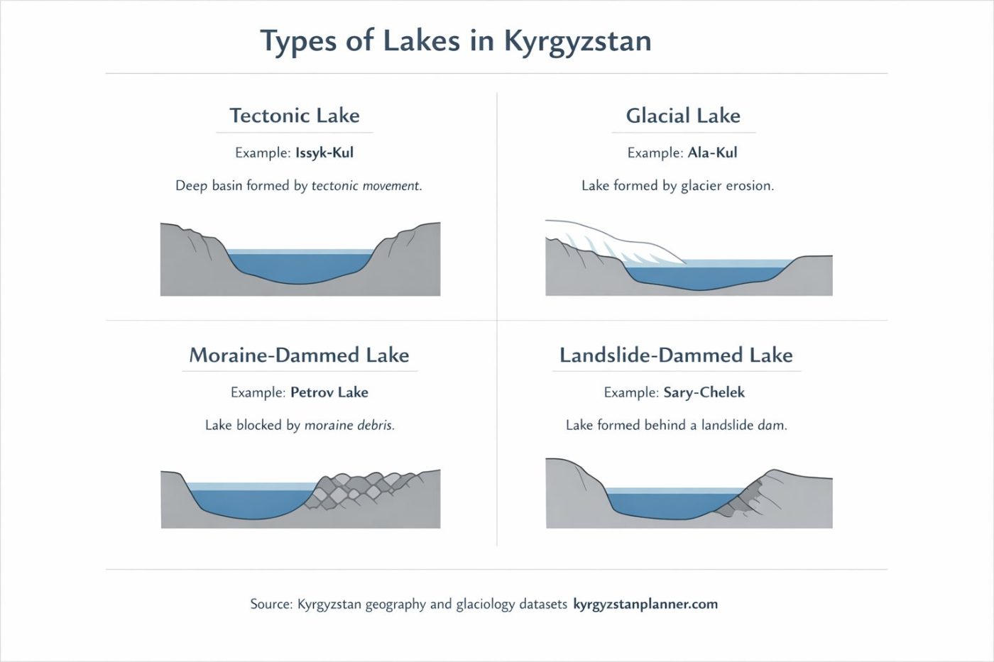
For this reason geographers usually classify the lakes of Kyrgyzstan according to the origin of their basins. Some lakes formed millions of years ago through tectonic processes, while others appeared much more recently as glaciers retreated or mountain slopes collapsed. Understanding these formation processes helps explain why the country contains both enormous lakes such as Issyk-Kul and hundreds of much smaller alpine lakes scattered across high mountain valleys.
Tectonic Lakes
The largest lakes in Kyrgyzstan belong to the tectonic category. These lakes occupy structural depressions created by faulting and deformation within the Tian Shan mountain system. Over long geological periods these basins gradually filled with water from rivers, snowmelt, and underground sources.
The most important tectonic lakes include:
- Issyk-Kul
- Son-Kul
- Chatyr-Kul
Among these, Issyk-Kul is by far the largest and deepest. Its basin formed along major tectonic faults between two mountain ranges and gradually developed into one of the largest high-altitude lakes on Earth.
Glacial Lakes
Glacial lakes are the most widespread type of lake in Kyrgyzstan. They form in depressions carved by glaciers or in basins where meltwater accumulates behind natural barriers created by glacial debris.
Because Kyrgyzstan contains thousands of glaciers, glacial lakes occur throughout many high mountain regions, particularly in the central and eastern Tian Shan. These lakes are typically small and located at elevations above 3,000 meters.
Examples of well-known glacial lakes include:
- Ala-Kul
- Kol-Ukok
- Tulpar-Kol
- Petrov Lake
Many of these lakes are surrounded by moraines — ridges of rock debris left behind by retreating glaciers — which help create natural basins that retain meltwater.
Moraine-Dammed Lakes
A special type of glacial lake forms when a moraine acts as a natural dam across a valley. Water accumulates behind the debris ridge and gradually forms a lake.
Moraine-dammed lakes are common in glaciated valleys of the Tian Shan. While many remain stable for long periods, some can pose hazards if the natural dam becomes unstable.
In such cases the lake may suddenly drain in an event known as a glacial lake outburst flood (GLOF). These events can release large volumes of water and debris downstream within a short period of time.
Landslide-Dammed Lakes
Another group of lakes forms when landslides block mountain valleys. When large masses of rock collapse into a river valley they may create a natural dam that traps water upstream.
The best-known example in Kyrgyzstan is Sary-Chelek, located in the western Tian Shan mountains. The lake formed thousands of years ago when a massive landslide blocked a valley and created a deep enclosed basin.
Today Sary-Chelek lies within a protected biosphere reserve and represents one of the most scenic forest lakes in Central Asia.
Ice-Dammed Lakes
A rarer type of lake occurs when glacier ice itself forms a temporary barrier that traps meltwater. These ice-dammed lakes are often unstable because glaciers move and melt over time.
One of the most famous examples is Merzbacher Lake in the central Tian Shan. Each year the lake fills during the summer melt season and then drains suddenly through subglacial channels beneath the surrounding glacier.
This unusual cycle has made Merzbacher Lake an important research site for scientists studying glacier dynamics and mountain hydrology.
Elevation Distribution of Lakes in Kyrgyzstan
One of the defining characteristics of Kyrgyzstan’s lakes is their elevation. Unlike many regions of the world where lakes occur mainly in lowland basins, most lakes in Kyrgyzstan lie high in the mountains. This pattern reflects the country’s extreme topography, where much of the terrain rises above 2,000 meters above sea level.
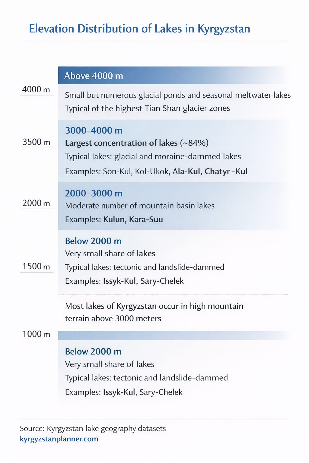
A historical source chain cited in the scientific literature reports that 84.3% of lakes in the Tian Shan fall within the 3,000–4,000 meter elevation belt. Dataset does not treat this as a verified modern percentage for all lakes in Kyrgyzstan: the statistic is regional in scope and the underlying 1975 source has been bibliographically identified but not fully re-audited from the original text.
Large lakes are relatively rare and usually occupy tectonic basins at moderate elevations. In contrast, the majority of lakes are located within the high-mountain belt of the Tian Shan, where glaciers, snowfields, and steep terrain create ideal conditions for the formation of alpine lakes.
Elevation Zones of Lakes
| Elevation Range | Typical Lake Types | Examples |
|---|---|---|
| 1500–2000 m | Tectonic basin lakes | Issyk-Kul, Sary-Chelek |
| 2000–3000 m | Mountain basin and landslide lakes | Kara-Suu, Kulun |
| 3000–3500 m | Plateau and glacial lakes | Son-Kul, Kol-Ukok |
| 3500–4000 m | High alpine glacial lakes | Chatyr-Kul, Ala-Kul |
| Above 4000 m | Small glacial ponds and seasonal meltwater lakes | Various lakes in the Central Tian Shan |
Distribution of Lakes by Elevation
| Elevation Range | Share of Lakes | Typical Lake Types | Characteristics |
|---|---|---|---|
| Below 2000 m | Very small share | Tectonic and landslide lakes | Includes large basins such as Issyk-Kul |
| 2000–3000 m | Moderate share | Mountain basin lakes | Often located in intermontane valleys |
| 3000–4000 m | Major high-mountain concentration; historical Tian Shan estimate 84.3% | Glacial and moraine-dammed lakes | Main alpine lake zone of the Tian Shan |
| Above 4000 m | Small but numerous | Small glacial ponds | Often seasonal meltwater lakes |
Highest Lakes of Kyrgyzstan
Many of Kyrgyzstan’s lakes lie at very high elevations in the Tian Shan and Pamir-Alay mountains.
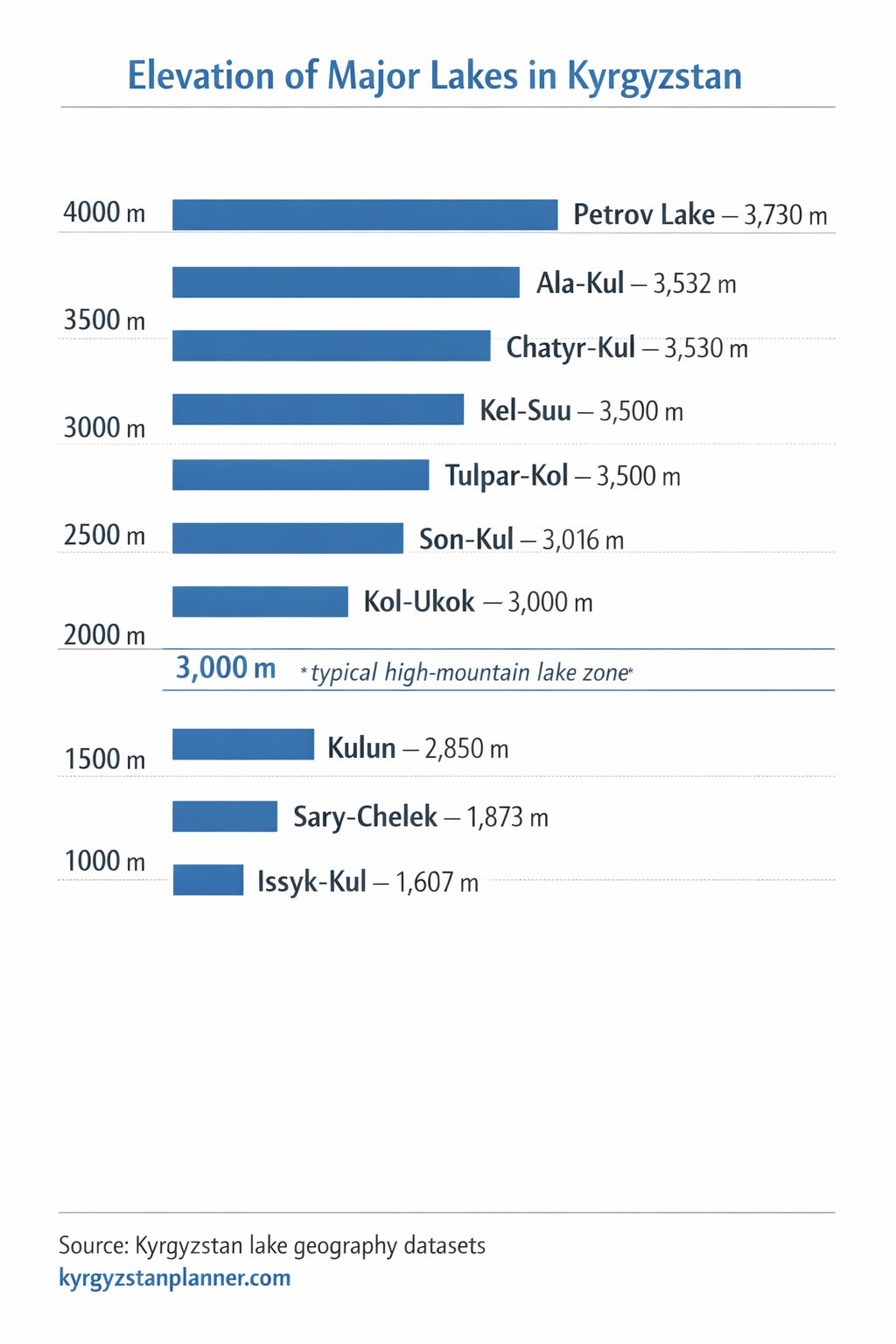
Several well-known alpine lakes are located above 3,500 meters above sea level, making them
among the highest permanent lakes in Central Asia.
| Lake | Elevation (m) | Type | Mountain Region |
|---|---|---|---|
| Petrov Lake | 3,741 | Glacial / Moraine-dammed | Ak-Shyyrak Massif (Central Tian Shan) |
| Ala-Kul | 3,560 | Glacial | Terskey Ala-Too |
| Chatyr-Kul | ~3,530 | High-altitude basin | At-Bashy Range |
| Kel-Suu | 3,514 | Alpine basin lake | Kok-Kiya Valley |
| Tulpar-Kol | ~3,500 | Glacial | Trans-Alay Range |
These lakes illustrate the extreme altitude of Kyrgyzstan’s lake geography. Many are located
near major glacier systems or high mountain passes, and several remain frozen for much of the year.
Why High-Altitude Lakes Are So Common
- Glacial erosion: glaciers carve depressions in mountain valleys.
- Moraine barriers: glacial debris forms natural dams.
- Enclosed terrain: steep slopes create natural basins.
- Seasonal snowmelt: meltwater feeds many alpine lakes.
These conditions are particularly widespread in the central Tian Shan mountains, where glaciers remain active and continue to shape the landscape. As glaciers retreat, new lakes sometimes appear while existing lakes expand or change.
Glacial Lakes and Mountain Hydrology
Glacial lakes represent one of the most dynamic components of Kyrgyzstan’s lake system. A national Sentinel-2 inventory mapped 2,592 glacial lakes in 2024 with a combined area of 77.6 km² under that study’s definition. This modern inventory should not be directly compared with the older 1,923-lake national statistic because the scope, date, and mapping criteria are different.
The Tian Shan mountains contain thousands of glaciers that store snow and ice during winter and release meltwater during warmer months. This meltwater feeds rivers, streams, and alpine lakes throughout the region.
In total, Kyrgyzstan contains nearly 10,000 glaciers, which serve as natural water reservoirs in the high mountains. Seasonal melting of these glaciers feeds rivers, streams, and many alpine lakes throughout the Tian Shan mountain system.
As glaciers advance and retreat they leave behind complex terrain filled with rock basins, moraines, and natural dams. These features create ideal conditions for the formation of glacial lakes.
Major Glacial Lake Regions
- Terskey Ala-Too Range
- Kyrgyz Range
- Central Tian Shan (Ak-Shyyrak Massif)
- Kokshaal-Too Range
- Pamir-Alay Mountains
In these mountain regions glacial lakes often occur in clusters within the same valley system.
Largest Glacial Lakes of the Tian Shan
The Tian Shan mountains contain thousands of glacial and moraine-dammed lakes
formed by past and present glacier activity. Most of these lakes are small alpine
basins, but several are well known for their size, scientific importance, or
connection to major glacier systems.
| Lake | Approx. Area (km²) | Elevation (m) | Type | Mountain Region |
|---|---|---|---|---|
| Petrov Lake | 3.9 | 3,741 | Moraine-dammed glacial lake | Ak-Shyyrak Massif (Central Tian Shan) |
| Ala-Kul | 1.6 | 3,560 | Glacial alpine lake | Terskey Ala-Too |
| Tulpar-Kol | ~1.0 | ~3,500 | Glacial lake | Trans-Alay Range (Pamir-Alay) |
| Kol-Ukok | 1.6 | 3,048 | Glacial lake | Naryn Region |
| Merzbacher Lake | Variable | ~3,300 | Ice-dammed glacial lake | Central Tian Shan (Inylchek Glacier) |
The 2024 national inventory mapped 2,592 glacial lakes. Regional studies also show how quickly this population can change: a 2017–2019 inventory of the Kyrgyz and Teskey ranges counted 800 lakes in 2019, including 242 with significant area variation, 46 newly emerging lakes, and 18 lakes that vanished during the study period.
Many other smaller glacial lakes occur throughout the Tian Shan, particularly in
the Central Tian Shan, Terskey Ala-Too, and Kokshaal-Too ranges. Because glaciers
continue to retreat in some regions, new lakes occasionally appear while existing
lakes expand or change shape.
Glacial Lake Outburst Floods
Some glacial lakes may pose natural hazards, but the drainage mechanism is not always the same. Kyrgyzstan Lakes Dataset keeps event records separately from ordinary lake morphometry so that an outburst is tied to a specific date, source, mechanism, and pre-/post-event state.
| Lake / Event | Date | Documented Water Loss | Mechanism / Note |
|---|---|---|---|
| Western Zyndan | 24 July 2008 | ~437,000 m³ | GLOF through a subsurface dead-ice channel; lake area fell from 0.0422 to 0.0083 km² |
| Kashkasuu | 2006 | ~194,000 m³ | Short-lived tunnel-type drainage |
| Jeruy | 15 August 2013 | ~182,000 m³ | Short-lived tunnel-type drainage |
| Karateke | 17 July 2014 | ~123,000 m³ | Short-lived tunnel-type drainage |
| Toguz-Bulak | 8 August 2019 | ~130,000 m³ | Moraine-dam breach; estimated maximum discharge ~183 m³/s |
These cases show why “glacial lake” is not itself a hazard category. Stability depends on the lake’s dam, glacier contact, drainage pathways, seasonal development, and local geomorphology.
Glacial Lakes and Climate Change
Recent decades have seen noticeable changes in many glacial lakes across the Tian Shan. As glaciers retreat, new lakes sometimes appear in recently exposed valleys, while existing lakes may expand.
For researchers, glacial lakes therefore serve as indicators of environmental change in high mountain regions.
Why Kyrgyzstan Is Called the Water Tower of Central Asia
Because of its extensive mountain systems and large number of glaciers, Kyrgyzstan is often
described as the “water tower of Central Asia.” The high ranges of the Tian Shan store enormous
amounts of freshwater in the form of glaciers, seasonal snowfields, mountain lakes, and underground
water reserves.
These natural reservoirs play a crucial role in the regional hydrological system. During the
spring and summer melt season, glacier and snowmelt feed thousands of rivers that flow across
Central Asia. Many of these rivers ultimately contribute to the Syr Darya basin, one of the
largest river systems in the region.
The importance of Kyrgyzstan’s mountain water resources extends far beyond its national borders.
Water originating in the Tian Shan supports agriculture, ecosystems, and settlements across
neighboring countries including Kazakhstan and Uzbekistan.
| Water Resource | Approximate Amount |
|---|---|
| Lakes | ~1,900 |
| Glaciers | ~9,900 |
| Rivers and streams | 3,500+ |
| Total lake water volume | ~1,745 km³ |
Because of this concentration of high-mountain water resources, Kyrgyzstan functions as one of
the main freshwater storage regions of Central Asia. Changes in glacier size, snow cover, or
mountain climate therefore have important implications for water availability throughout the region.
Lake Clusters by Mountain Range
The distribution of lakes across Kyrgyzstan closely follows the structure of its mountain systems. Large tectonic lakes occupy major intermountain depressions, while smaller alpine lakes are scattered throughout glaciated valleys.
Major Lake Regions of Kyrgyzstan
| Region | Main Lakes | Mountain System | Typical Lake Types |
|---|---|---|---|
| Issyk-Kul Basin | Issyk-Kul | Tian Shan | Tectonic basin lake |
| Naryn Plateau | Son-Kul, Kol-Ukok | Inner Tian Shan | Plateau and glacial lakes |
| At-Bashy Basin | Chatyr-Kul | At-Bashy Range | High-altitude basin lake |
| Terskey Ala-Too | Ala-Kul | Tian Shan | Glacial alpine lakes |
| Central Tian Shan | Petrov Lake, Merzbacher Lake | Ak-Shyyrak Massif | Glacial and ice-dammed lakes |
| Chatkal Mountains | Sary-Chelek | Western Tian Shan | Landslide-dammed lakes |
| Pamir-Alay | Tulpar-Kol, Kulun | Pamir-Alay | High-mountain glacial lakes |
Together these lake regions illustrate how Kyrgyzstan’s lakes are closely connected to its mountainous terrain. From the vast tectonic basin of Issyk-Kul to small glacial lakes high in the Tian Shan, the country’s lakes form a diverse network shaped by geology, climate, and mountain hydrology.
Mountain Lakes of Central Asia
Kyrgyzstan is not the only country in Central Asia with mountain lakes, but its lake
distribution is unusual because most lakes are located in high mountain terrain.
Other countries of the region have different lake systems shaped by deserts, plains,
or large inland basins.
| Country | Approximate Number of Lakes | Main Lake Regions |
|---|---|---|
| Kyrgyzstan | ~1,900 | Tian Shan and Pamir-Alay mountains |
| Kazakhstan | ~48,000 | Northern steppe lakes, Balkhash basin |
| Tajikistan | ~1,300 | Pamir mountains |
| Uzbekistan | Relatively few natural lakes | Mostly reservoirs and remnants of the Aral basin |
Compared with its neighbors, Kyrgyzstan stands out for the density of high-altitude
mountain lakes concentrated in the Tian Shan range.
Largest Lakes in Central Asia
Central Asia contains several very large inland lakes and inland seas.
While Kyrgyzstan’s Issyk-Kul is the largest lake within the country,
other countries in the region contain much larger basins.
| Lake | Country / Region | Surface Area (km²) | Notes |
|---|---|---|---|
| Caspian Sea | Kazakhstan, Russia, Azerbaijan, Iran, Turkmenistan | ~371,000 | World’s largest inland water body |
| Lake Balkhash | Kazakhstan | ~16,400 | Large endorheic lake with both fresh and saline sections |
| Issyk-Kul | Kyrgyzstan | 6,236 | Largest lake in Kyrgyzstan |
| Aral Sea | Kazakhstan / Uzbekistan | Rapidly shrinking | Formerly one of the largest lakes in the world |
Kyrgyzstan Lakes Dataset
The structured data behind this guide is available as the Kyrgyzstan Lakes Dataset, an open, source-traceable reference and evidence dataset covering selected lakes, published morphometry, glacial-lake dynamics, source lineage, conflicts, and national or regional lake-inventory statistics.
Unlike the summary tables in this guide, Kyrgyzstan Lakes Dataset is not organized as a ranking of the “largest” or “best-known” lakes. The data has been rebuilt around stable entity IDs, source-specific measurements, explicit comparability groups, audited reference decisions, dated observations, and documented alternative or conflicting values.
- 73 lake, lake-complex, and unresolved inventory entities in the master registry
- 166 source-specific morphometric measurement records
- 63 lake entities in the simplified audited public reference table
- 129 selected reference measurements audited, with 119 public-eligible values and 10 deliberately withheld from the simplified reference layer
- 11 documented glacial-lake drainage or outburst events and 26 dated lake observations
- 9 study-local ephemeral glacial-lake features retained without promoting them to permanent geographic lake entities
- 37 referenced sources with source-quality, rights, and provenance metadata
- 21 tabular resources with embedded machine-readable schemas and a release validation report covering 110 checks with 0 failures
The dataset is curated rather than exhaustive. It is designed as a source-traceable geographic and hydrological reference resource, not as a complete national polygon inventory of every lake in Kyrgyzstan. Dynamic glacial lakes are represented with dated observations and event records where the evidence supports them.
Download the Dataset
For most users, the complete package is the easiest option. It includes the core CSV and GeoJSON files together with the source registry, conflict records, source lineage, data dictionary, methodology, rights metadata, validation report, checksums, workbook, and machine-readable Data Package metadata.
Download the complete Kyrgyzstan Lakes Dataset (ZIP)
Permanent archive and citation:
Kyrgyzstan Lakes Dataset v1.0.0 on Zenodo
(DOI: 10.5281/zenodo.22178862).
Individual Data Files
| File | Contents |
|---|---|
| kyrgyzstan_lakes.csv | Master registry of 73 researched lake, lake-complex, and unresolved inventory entities with stable dataset IDs and representative geographic metadata. |
| kyrgyzstan_lake_reference_public.csv | Simplified audited reference table for 63 lake entities with at least one public core value for area, elevation, maximum depth, or volume. |
| kyrgyzstan_lake_measurements.csv | Full source-specific morphometric evidence layer, including alternative values, ranges, observation context, methods, confidence, and reference-selection status. |
| kyrgyzstan_glacial_lake_events.csv | Documented glacial-lake drainage and outburst events with dates, mechanisms, pre/post-event states, drained volumes, impacts, and source locators. |
| kyrgyzstan_lake_observations.csv | Dated lake states and changes, including appearance, growth, drainage, recharge, water-level change, and volume change where recoverable from the literature. |
| kyrgyzstan_lakes.geojson | Source-traceable representative WGS84 points for lake entities with sufficiently resolved coordinate provenance. This is a point layer, not a shoreline-polygon inventory. |
| kyrgyzstan_lake_sources.csv | Source registry covering official, peer-reviewed, institutional, gazetteer, historical, and supporting references used by Kyrgyzstan Lakes Dataset. |
| kyrgyzstan_lake_conflict_register.csv | Explicit record of conflicting, non-comparable, scope-misattributed, or identity-sensitive published values and the curation decision applied to each case. |
| kyrgyzstan_lake_source_lineage.csv | Source-to-source provenance showing when later publications reuse, update, or depend on earlier lake inventories and case studies. |
Documentation and Reuse
- Dataset README — scope, structure, release scale, limitations, and recommended entry points.
- Methodology — source hierarchy, comparability groups, reference-selection rules, conflict handling, dynamic-lake treatment, and public-reference audit.
- Data dictionary — field-level definitions, requirements, formats, and schema notes for the released tabular resources.
- Validation report — machine-readable release validation covering schemas, primary and foreign keys, list-valued relations, GIS structure, public-reference semantics, and metadata consistency.
- Rights and reuse — Kyrgyzstan Lakes Dataset licensing boundary and source-specific third-party rights handling.
Published lake areas, elevations, depths, volumes, and classifications sometimes differ between official tables, scientific studies, international databases, and secondary references. Dataset does not silently discard those disagreements: source-specific values remain in kyrgyzstan_lake_measurements.csv, while important conflicts are documented in kyrgyzstan_lake_conflict_register.csv.
The simplified public reference layer is deliberately conservative. Values may be withheld when they are strongly time-variable, context-specific, scenario-based, definition-dependent, or affected by an unresolved high-priority conflict. The underlying evidence remains available in the full dataset.
The dataset is intended for educational, geographic, hydrological, travel, and research use. Kyrgyzstan Lakes Dataset-original schema, identifiers, curation, documentation, and database organization are released under CC BY 4.0. Third-party publications and datasets listed in the source registry are referenced but are not redistributed and remain subject to their own copyright and licence terms.
Sources and References
Geographic data and statistics presented in this guide are compiled from official
statistical publications of the Kyrgyz Republic, regional water resource reports,
international lake databases, and scientific studies on the Tian Shan mountain system
and Central Asian hydrology.
- National Statistical Committee of the Kyrgyz Republic.
Environment in the Kyrgyz Republic.
Statistical compilation with data on lakes, rivers, glaciers, and water resources. - National Statistical Committee of the Kyrgyz Republic.
20 Years of Independence of the Kyrgyz Republic.
Statistical overview including national geographic indicators and lake statistics. - CAWater-Info.
The Kyrgyz Republic National Water Report.
Regional report on water resources of Central Asia including lake area,
river networks, and water storage estimates. - Central Asian Water Information Portal (CAWater-Info).
Regional hydrological publications on water resources of the Tian Shan
and Central Asian river basins. - De Batist, M. et al. (2002).
Bathymetry and Sedimentary Environments of Lake Issyk-Kul, Kyrgyz Republic
(Central Asia): A Large, High-Altitude, Tectonic Lake.
In Lake Issyk-Kul: Its Natural Environment, pp. 101–123.
DOI: 10.1007/978-94-010-0491-6_9.
Used for Issyk-Kul bathymetry and morphometric figures, including a surface area of 6,236 km² and the commonly cited maximum-depth figure of 668 m. - International Lake Environment Committee (ILEC).
World Lake Database — Lake Issyk-Kul.
International reference database for lake morphology and physical characteristics,
including surface area and maximum depth. - Janský, B., Engel, Z., Šobr, M. et al. (2009).
The evolution of Petrov Lake and moraine dam rupture risk
(Tien-Shan, Kyrgyzstan). Natural Hazards, 50, 83–96.
DOI: 10.1007/s11069-008-9321-8.
Used for Petrov Lake geography, development, and glacial-lake characteristics. - Narama, C. et al. (2018).
Large drainages from short-lived glacial lakes in the Teskey Range, Tien Shan Mountains, Central Asia.
Natural Hazards and Earth System Sciences, 18, 983–995.
DOI: 10.5194/nhess-18-983-2018.
Used for Kashkasuu, Jeruy, Karateke, and Western Zyndan drainage-event evidence. - Narama, C. et al. (2010).
The 24 July 2008 outburst flood at the western Zyndan glacier lake and recent regional changes in glacier lakes of the Teskey Ala-Too range, Tien Shan, Kyrgyzstan.
DOI: 10.5194/nhess-10-647-2010.
Used for the Western Zyndan growth sequence and GLOF reconstruction. - Daiyrov, M. et al. (2022).
Evaluating the variability of glacial lakes in the Kyrgyz and Teskey ranges, Tien Shan.
Frontiers in Earth Science.
DOI: 10.3389/feart.2022.850146.
Used for the 2017–2019 regional glacial-lake inventory and variability statistics. - Kyrgyzstan Lakes Dataset
Source-traceable lake entities, measurements, conflicts, glacial-lake events, dated observations, source lineage, rights metadata, and audited reference views compiled for KyrgyzstanPlanner.
Elevation values, lake classifications, and descriptions of alpine lakes
are based on geographic and glaciological publications on the Tian Shan,
together with regional mapping data and satellite-based geographic surveys.