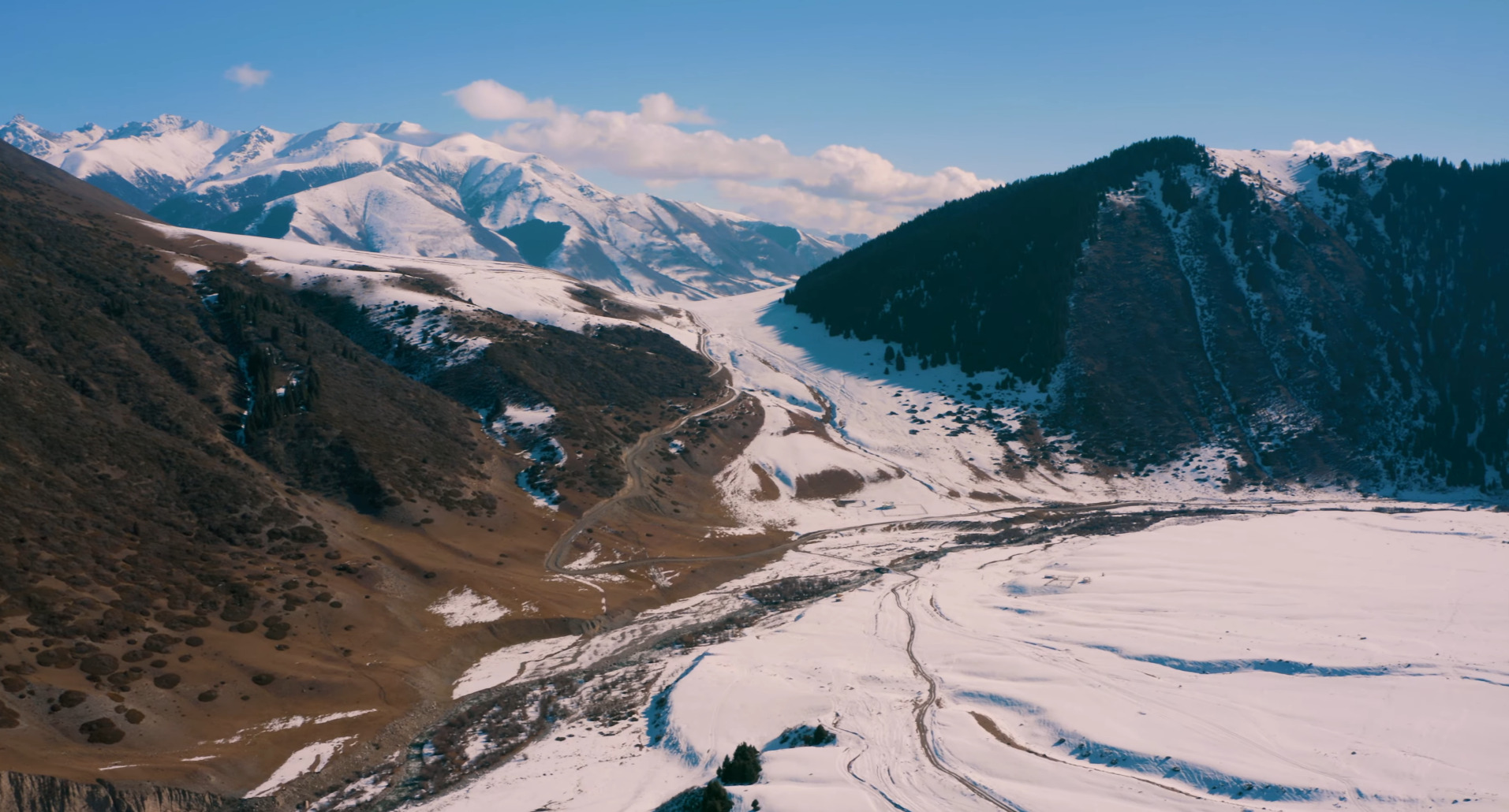
Mountains of Kyrgyzstan: The Complete Guide to Ranges, Peaks and High-Altitude Landscapes
Last updated: August 2026. Geographic data compiled from official statistical publications, alpine reference databases, and regional geographic sources.
Quick Facts About the Mountains of Kyrgyzstan
| Question | Quick Answer |
|---|---|
| Is Kyrgyzstan a mountainous country? | Yes. Current Kyrgyz government sources describe about 94% of the country as mountainous, while the World Bank reported 90% in 2025. These figures should be kept separate from elevation-threshold statistics. |
| Main mountain systems | The two main mountain systems are the Tian Shan and Pamir-Alay. |
| Highest mountain | Jengish Chokusu, also known as Pobeda Peak or Victory Peak, at 7,439 meters. |
| Major 7,000-meter peaks | Jengish Chokusu and Lenin Peak are above 7,000 meters by rock elevation. Khan Tengri is often listed around 7,010 meters when its ice cap is included. |
| Best mountain regions for travelers | Ala Archa, Karakol, Altyn Arashan, Ala-Kul, Song-Kul, Kel-Suu and the Alay Valley. |
| Best season for mountain travel | June to September for most routes; July and August for the most reliable high-elevation access. |
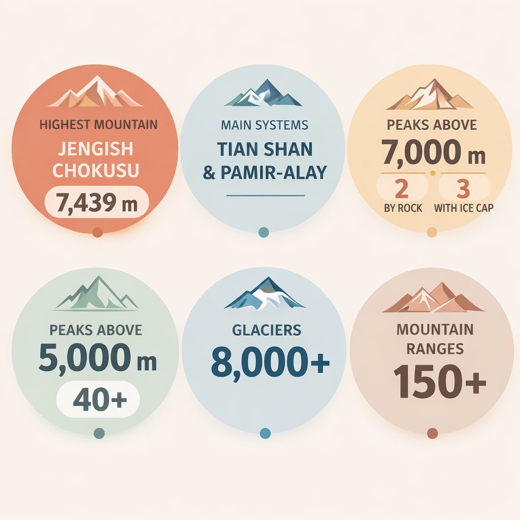
The mountains shape almost every aspect of Kyrgyzstan’s geography. Rivers originate in glacier systems high in the Tian Shan. Large alpine lakes such as Issyk-Kul and Song-Kul occupy mountain basins between major ranges. Even population distribution reflects the terrain, with most settlements concentrated in valleys surrounded by steep ridgelines and high plateaus.
Two major mountain systems dominate the country. The vast Tian Shan Mountains stretch across most of Kyrgyzstan, forming a network of ridges, glacier basins, and high alpine valleys. In the south, the landscape transitions into the Pamir-Alay system, where some of the highest peaks in Central Asia rise above the Alay Valley.
Within these systems stand several of the most famous mountains in the region. Jengish Chokusu, also known as Pobeda Peak, reaches 7,439 meters and represents the highest point of Kyrgyzstan and the entire Tian Shan range. Nearby rises Khan Tengri, one of the most striking pyramidal peaks in Asia. Farther south, Lenin Peak dominates the skyline of the Pamir-Alay mountains at 7,134 meters.
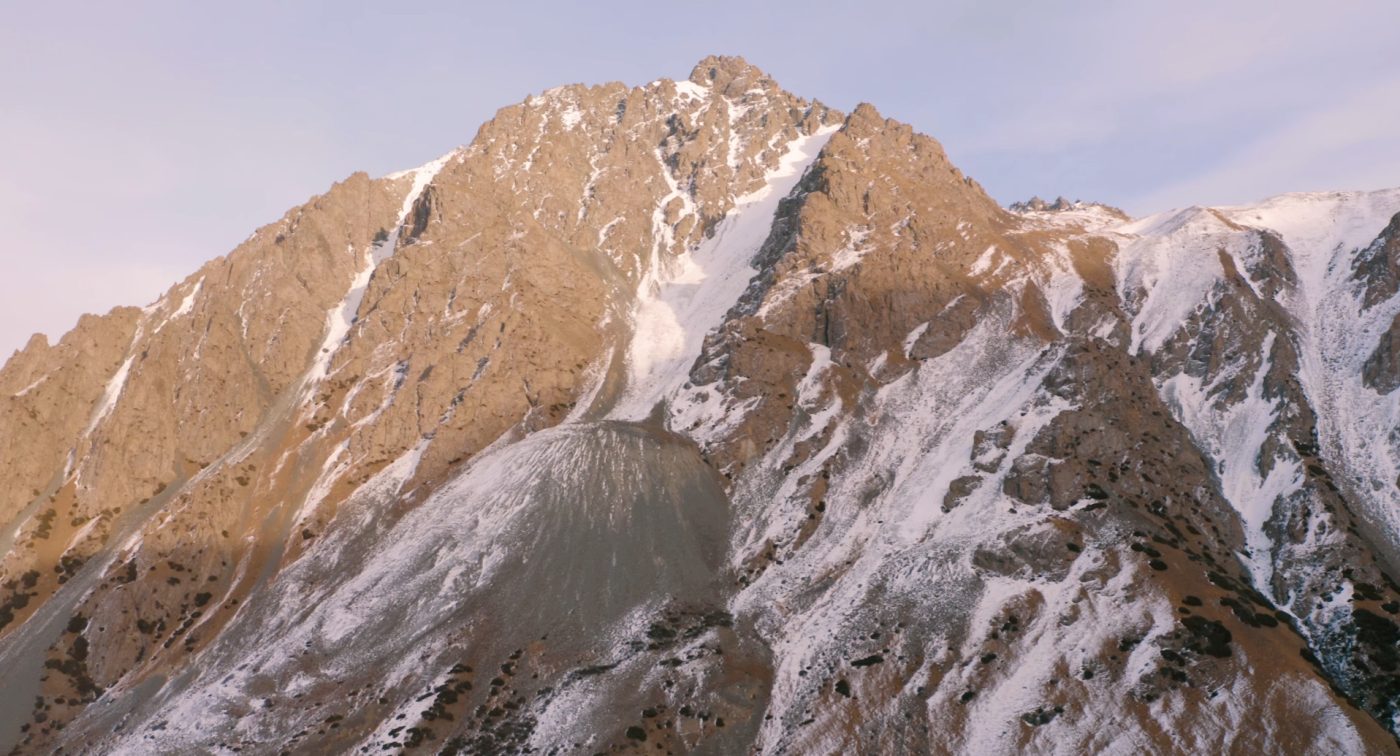
Yet the geography of Kyrgyzstan’s mountains extends far beyond a few famous summits. The country contains numerous named mountain ranges, high mountain basins, and some of the largest glacier systems in Central Asia. Together they form a complex alpine landscape that continues to attract researchers, climbers, and travelers from around the world.
Overview of the Mountains of Kyrgyzstan
Kyrgyzstan ranks among the most mountainous countries on Earth. Current Kyrgyz government sources describe about 94 percent of the national territory as mountainous, while the World Bank reported 90 percent in 2025. Separately, official elevation statistics indicate that about 94.2 percent of the country lies above 1,000 meters, around 90 percent above 1,500 meters, and 40.8 percent above 3,000 meters.
These elevations create dramatic variations in climate and landscape. Lower valleys support agriculture and human settlement, while higher elevations transition into alpine meadows, rocky plateaus, and extensive glacier systems.
Several key characteristics define the mountain geography of Kyrgyzstan:
- Most of the country belongs to the Tian Shan mountain system.
- The southern border region connects to the Pamir-Alay mountains.
- Mountain geography is organized through numerous ranges, massifs, and high-mountain areas across the Tian Shan and Pamir-Alay.
- The country contains 2 peaks above 7,000 meters (3 including Khan Tengri ice cap).
- Large glaciers feed the headwaters of major Central Asian rivers.
Because of this geography, Kyrgyzstan’s mountain systems form an essential part of the broader Central Asian alpine region. The Tian Shan alone stretches nearly 2,800 kilometers across several countries, with Kyrgyzstan occupying one of its most rugged and elevated sections.
Understanding how these mountains are organized requires looking beyond individual peaks. The landscape is structured through a hierarchy of mountain systems, ranges, glacier basins, and valleys that together create the complex topography of Kyrgyzstan.
Mountain Systems of Kyrgyzstan
The mountains of Kyrgyzstan belong primarily to two major mountain systems of Central Asia: the Tian Shan and the Pamir-Alay. Together these systems form a vast high-elevation mountain region stretching across several countries, but Kyrgyzstan occupies one of the most mountainous sections of this landscape.
The majority of the country lies within the Tian Shan, often translated as the “Heavenly Mountains.” This immense mountain chain extends across nearly 2,800 kilometers from Uzbekistan in the west to China in the east. Some of the highest and most rugged parts of the range are located inside Kyrgyzstan, where glaciers, alpine ridges, and deep valleys dominate the terrain.
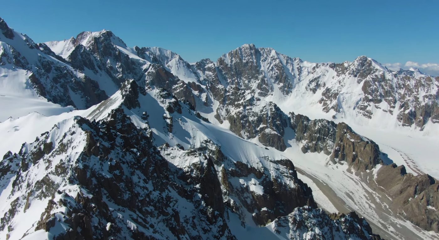
In the southern part of the country the geography changes slightly. Here the mountains gradually merge with the Pamir-Alay system, a network of high ranges that connect the Tian Shan with the greater Pamir Mountains. This region includes the dramatic Alay Valley and several of the highest peaks accessible to mountaineers in Central Asia.
Although the Tian Shan and Pamir-Alay belong to the same broad zone of active mountain building in Central Asia, their modern tectonic settings are not identical. The Tian Shan forms a major intracontinental mountain belt, actively deforming far north of the main India–Eurasia collision zone, while the Pamir-Alay in southern Kyrgyzstan is more directly connected to the Pamir mountain system.
Tian Shan Mountains
The Tian Shan dominates the geography of Kyrgyzstan. Most of the country’s highest mountains, glacier systems, and major alpine valleys belong to this enormous mountain chain. Within Kyrgyz territory the Tian Shan forms a complex structure of ridges and subranges that stretch across the country from west to east.
Several regional divisions are commonly used to describe the Kyrgyz portion of the Tian Shan:
- Northern Tian Shan — ranges surrounding the Chuy Valley and Issyk-Kul basin.
- Central Tian Shan — the highest and most glaciated region, home to Pobeda Peak and Khan Tengri.
- Inner Tian Shan — a network of interior ranges and high plateaus around Naryn.
- Western Tian Shan — mountains extending toward Uzbekistan and Kazakhstan.
Each of these regions contains multiple mountain ranges with their own peaks, valleys, and glacier systems. Some ranges form natural borders between countries, while others surround high mountain lakes or isolated plateaus deep within the interior of Kyrgyzstan.
Many of the country’s best-known landscapes are located in the northern Tian Shan. The Issyk-Kul basin, for example, is framed by two massive mountain walls: the Kungey Ala-Too range to the north and the Terskey Ala-Too range to the south. Farther west, Chon-Kemin Valley adds another accessible northern Tian Shan landscape of forested slopes, river valleys and high pastures. These mountains rise sharply above the lake and create one of the most striking alpine environments in Central Asia.
Pamir-Alay Mountains
The southern mountains of Kyrgyzstan belong to the Pamir-Alay system, which forms the northern edge of the larger Pamir mountain region. Although this system occupies a smaller portion of Kyrgyz territory compared with the Tian Shan, it contains some of the most dramatic landscapes in the country.
The most prominent feature of this region is the Trans-Alay Range, which rises above the wide Alay Valley along the border between Kyrgyzstan and Tajikistan. The range includes Lenin Peak, one of the highest mountains in Central Asia and a major destination for international mountaineering expeditions.
Unlike the heavily glaciated highlands of the central Tian Shan, many Pamir-Alay mountains rise sharply above wide valleys and plateaus. The contrast between the flat Alay Valley and the towering ridges above it creates one of the most dramatic mountain panoramas in the entire region.
These southern mountains also form an important geographic transition zone linking the Tian Shan with the greater Pamir Plateau further south.
Why the Tian Shan Is Still Tectonically Active
The modern Kyrgyz Tian Shan is not simply the remains of an ancient mountain system. Much of its present relief reflects renewed Cenozoic deformation associated with the India–Eurasia collision, even though the range lies far north of the main plate boundary. Seismic studies of the Kyrgyz Tian Shan show particularly thick crust beneath the southern ranges and evidence that the Tarim Basin is being underthrust beneath the mountain belt.
The tectonic setting also changes across Kyrgyzstan. West of the Talas-Fergana Fault, deformation is more strongly influenced by shortening associated with the Pamir and Hindu Kush region. Farther east, the central Tian Shan is more closely linked to convergence involving the Tarim Basin to the south and the Kazakh Shield to the north. This helps explain why the mountain ranges of Kyrgyzstan do not behave as one simple geological block, even though they appear to form a continuous mountain landscape.
Best Mountain Regions to Visit in Kyrgyzstan
Most travelers do not need to visit Kyrgyzstan’s highest peaks to experience the country’s mountains. The best mountain regions for a first trip are usually the accessible valleys, lakes and trekking bases connected to Bishkek, Issyk-Kul, Karakol and Naryn.
| Mountain Region | Best For | Good Starting Point | Best Time |
|---|---|---|---|
| Ala Archa | Easy mountain day trip, hiking, first taste of Kyrgyz mountains | Bishkek | May to October |
| Karakol and Terskey Ala-Too | Ala-Kul, Altyn Arashan, Jeti-Oguz, glacier valleys and serious trekking | Karakol | June to September |
| Song-Kul | Yurt stays, jailoo landscapes, horse riding and high mountain pastures | Kochkor or Naryn | Late June to early September |
| Kel-Suu and Naryn Region | Remote alpine lake, 4×4 adventure and high-elevation scenery | Naryn | Summer to early autumn |
| Alay Valley | Lenin Peak views, Pamir-Alay landscapes and southern mountain routes | Osh | Summer |
For route planning, compare this with our guides to the lakes of Kyrgyzstan, best time to visit Kyrgyzstan and horse riding tours in Kyrgyzstan.
Highest Mountains of Kyrgyzstan
Kyrgyzstan contains some of the highest mountains in Central Asia. Two summits have rock elevations above 7,000 meters — Jengish Chokusu and Lenin Peak — while Khan Tengri reaches approximately 7,010 meters when its ice cap is included. Many additional high summits rise across the Tian Shan and Pamir-Alay systems.
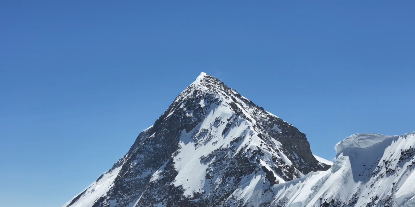
The highest mountain in the country is Jengish Chokusu, also known as Pobeda Peak. Rising to 7,439 meters, it stands as the highest summit of the Tian Shan. Lenin Peak reaches 7,134 meters in the Trans-Alay Range, while Khan Tengri has a 6,995-meter geologic summit and is commonly listed at approximately 7,010 meters when its ice cap is included.
The KMGD v2 peak list is curated rather than exhaustive. It separates major high peaks from additional notable summits and explicitly modeled range high points. The tables are sorted by reference elevation for readability and should not be interpreted as a complete national ranking.
Selected Major High Peaks of Kyrgyzstan

The following table contains the 23 major high-peak entities retained in KMGD v2 after source and identity review.
| # | Mountain | Reference Elevation | Mountain Unit | Mountain System |
|---|---|---|---|---|
| 1 | Jengish Chokusu | 7,439 m | Kakshaal Too | Tian Shan |
| 2 | Lenin Peak | 7,134 m | Trans-Alay Range | Pamir-Alay |
| 3 | Khan Tengri | 6,995 m (7,010 m with ice cap) | Tengri-Tag Range | Tian Shan |
| 4 | Kurumdy Mountain | 6,613 m | Trans-Alay Range | Pamir-Alay |
| 5 | Chapaev Peak | 6,371 m | Tengri-Tag Range | Tian Shan |
| 6 | Spartak Peak | 6,194 m | Trans-Alay Range | Pamir-Alay |
| 7 | Razdelnaya Peak | 6,148 m | Trans-Alay Range | Pamir-Alay |
| 8 | Dankova Peak | 5,982 m | Kakshaal Too | Tian Shan |
| 9 | Kyzyl-Asker | 5,842 m | Kakshaal Too | Tian Shan |
| 10 | Semenov Peak | 5,816 m | Sary-Jaz Range | Tian Shan |
| 11 | Nansen Peak | 5,697 m | Terskey Ala-Too | Tian Shan |
| 12 | Skalisty Peak | 5,621 m | Kara-Bel Range | Pamir-Alay |
| 13 | Soviet Constitution Peak | 5,281 m | Keolyu Range | Tian Shan |
| 14 | Karakol Peak | 5,216 m | Terskey Ala-Too | Tian Shan |
| 15 | Djigit Peak | 5,170 m | Terskey Ala-Too | Tian Shan |
| 16 | Boris Yeltsin Peak | 5,168 m | Terskey Ala-Too | Tian Shan |
| 17 | Semenov-Tian-Shansky Peak | 4,895 m | Kyrgyz Ala-Too | Tian Shan |
| 18 | West Alamedin Peak | 4,875 m | Kyrgyz Ala-Too | Tian Shan |
| 19 | Korona Peak | 4,860 m | Kyrgyz Ala-Too | Tian Shan |
| 20 | Chok-Tal Peak | 4,770 m | Kungey Ala-Too | Tian Shan |
| 21 | Free Korea Peak | 4,740 m | Kyrgyz Ala-Too | Tian Shan |
| 22 | Uchitel Peak | 4,527 m | Kyrgyz Ala-Too | Tian Shan |
| 23 | Manas Peak | 4,484 m | Talas Ala-Too | Tian Shan |
Additional Notable Peaks and Range High Points
The second table contains 19 additional notable peaks and explicitly modeled range high points. High-point labels are used where the underlying range maximum is better established than a standalone summit name.
| # | Mountain / High Point | Reference Elevation | Mountain Unit | Mountain System |
|---|---|---|---|---|
| 24 | Pyramidalny Peak | 5,509 m | Turkestan Range | Pamir-Alay |
| 25 | Borkoldoy Range High Point | 5,170 m | Borkoldoy Too | Tian Shan |
| 26 | Petrogradets Peak | 5,163 m | Turkestan Range | Pamir-Alay |
| 27 | Yukhin Peak | 5,130 m | Trans-Alay Range | Pamir-Alay |
| 28 | Mustyr Peak | 5,108 m | Torugart Too | Tian Shan |
| 29 | Parus Peak | 5,037 m | Turkestan Range | Pamir-Alay |
| 30 | It-Tish Peak | 4,808 m | Terskey Ala-Too | Tian Shan |
| 31 | Rhianydd Peak | 4,801 m | At-Bashy Range | Tian Shan |
| 32 | Palatka Peak | 4,733 m | Terskey Ala-Too | Tian Shan |
| 33 | Ulan Range High Point | 4,542 m | Ulan Range | Tian Shan |
| 34 | Aflatun Peak | 4,503 m | Chatkal Range | Tian Shan |
| 35 | Orto-Acha Peak | 4,499 m | Naryn Too | Tian Shan |
| 36 | Nura Range High Point | 4,460 m | Nura Range | Tian Shan |
| 37 | Usen Peak | 4,378 m | Turkestan Range | Pamir-Alay |
| 38 | Baybiche Too High Point | 4,337 m | Baybiche Too | Tian Shan |
| 39 | Przhevalsky Peak | 4,283 m | Terskey Ala-Too | Tian Shan |
| 40 | Asan Peak | 4,230 m | Turkestan Range | Pamir-Alay |
| 41 | Moldo Too High Point | 4,185 m | Moldo Too | Tian Shan |
| 42 | Kyzyl-Ompol High Point | 3,183 m | Kyzyl-Ompol Range | Tian Shan |
Jengish Chokusu (Pobeda Peak)
At 7,439 meters, Jengish Chokusu stands as the highest mountain in Kyrgyzstan and the entire Tian Shan mountain system. The peak lies within the Kakshaal Too range along the border between Kyrgyzstan and China. Known for its severe weather and complex ridge structure, Pobeda Peak is considered one of the most difficult 7,000-meter mountains in the world.
Lenin Peak
Lenin Peak rises to 7,134 meters and dominates the skyline of the Alay Valley in southern Kyrgyzstan. Located in the Trans-Alay Range, the mountain forms part of the northern edge of the Pamir Mountains. Because its routes are technically less complex than many peaks of similar height, Lenin Peak has become one of the most popular 7,000-meter summits for international climbers.
Khan Tengri
Khan Tengri is widely regarded as one of the most beautiful mountains in Central Asia. The peak reaches 6,995 meters above sea level, although its permanent ice cap brings the elevation to approximately 7,010 meters. Its sharply defined pyramid shape and marble summit make it one of the most recognizable mountains of the Tian Shan.
Major Mountain Ranges and Their Key Peaks
The mountains of Kyrgyzstan are organized into a large number of individual ranges, each with its own ridgelines, glacier basins, and high summits. While hundreds of peaks rise above the country’s valleys and plateaus, many of them are closely associated with specific mountain ranges that define the structure of the landscape.
Understanding these relationships between mountain ranges and their highest peaks helps reveal how the alpine geography of Kyrgyzstan is organized. Some ranges form long mountain walls along major valleys, while others create isolated highland systems deep within the interior Tian Shan.
The following ranges represent some of the most important mountain units in the country. Many of Kyrgyzstan’s best-known peaks rise within them.
Kakshaal Too Range
The Kakshaal Too Range forms part of the central Tian Shan along the border between Kyrgyzstan and China. This range contains the highest mountain in the entire country — Jengish Chokusu, also known as Pobeda Peak. Rising to 7,439 meters, the summit dominates one of the most rugged alpine regions in Central Asia.
The Kakshaal Too mountains are heavily glaciated and remain among the most remote parts of Kyrgyzstan. Large glacier systems, steep ridges, and extreme weather conditions make the region difficult to access, which has helped preserve its wild alpine landscape.
Trans-Alay Range
The Trans-Alay Range forms the northern edge of the Pamir mountain region and stretches along the border between Kyrgyzstan and Tajikistan. Its most prominent summit is Lenin Peak, which rises to 7,134 meters above the Alay Valley.
The dramatic contrast between the broad Alay Valley and the towering peaks of the Trans-Alay Range creates one of the most striking mountain panoramas in Central Asia. The range is also a major destination for mountaineering expeditions because of its high elevations and relatively accessible climbing routes.
Terskey Ala-Too Range
The Terskey Ala-Too Range forms the southern mountain wall of the Issyk-Kul basin. These mountains stretch for several hundred kilometers along the southern shore of the lake and contain numerous peaks exceeding 5,000 meters.
Among the most prominent summits of the range is Karakol Peak, which rises to approximately 5,216 meters. The Terskey Ala-Too mountains are also known for their alpine valleys, glaciers, and trekking routes around the Karakol region.
Kungey Ala-Too Range
North of Issyk-Kul lies the Kungey Ala-Too Range, which forms the northern boundary of the lake basin. Although slightly lower than the Terskey range, these mountains still reach elevations above 4,700 meters.
The highest summit of the range is Chok-Tal Peak. Together with the Terskey Ala-Too mountains, the Kungey Ala-Too creates the dramatic alpine basin that surrounds Issyk-Kul, one of the largest high-elevation lakes in the world.
Kyrgyz Ala-Too Range
The Kyrgyz Ala-Too Range stretches across northern Kyrgyzstan and forms part of the border with Kazakhstan. These mountains rise directly south of the Chuy Valley and the capital city of Bishkek.
The highest summit of the range is Semenov-Tian-Shansky Peak, reaching approximately 4,895 meters. Several other well-known peaks are located in this range, including West Alamedin Peak, which is a popular climbing destination within the Ala-Archa National Park.
Talas Ala-Too Range
The Talas Ala-Too Range forms an important western Tian Shan mountain wall along the Talas Valley and the Kyrgyzstan–Kazakhstan border.
The highest summit of the range is Manas Peak, which rises to about 4,484 meters. Although less visited than the mountains near Issyk-Kul, the Talas Ala-Too range represents an important part of Kyrgyzstan’s western alpine landscape.
Inner Tian Shan Ranges
Deep within the interior of Kyrgyzstan lies the region often referred to as the Inner Tian Shan. This area includes several mountain ranges such as the At-Bashy Range, Borkoldoy Too, and Naryn Too.
These ranges surround high plateaus and alpine basins where elevations often exceed 3,000 meters. While their peaks are generally lower than those of the central Tian Shan, the Inner Tian Shan mountains form a vast high-elevation landscape that defines much of central Kyrgyzstan.
Together these mountain ranges create the structural backbone of Kyrgyzstan’s geography. Each range contributes to the broader alpine system that shapes the country’s valleys, rivers, and high mountain ecosystems.
Major Mountain Ranges and Areas of Kyrgyzstan
The mountains of Kyrgyzstan are organized through a hierarchy of ranges, massifs, and high-mountain regions. KMGD v2 normalizes these geographic units so that peaks can be linked to a consistent mountain-unit structure rather than to a mixture of informal area names and range names.
The table below contains the 33 mountain units represented in KMGD v2. It is a curated reference set rather than a claim that Kyrgyzstan has exactly this number of mountain ranges. For transboundary ranges, the reference maximum may describe the full geographic unit rather than only the part inside Kyrgyzstan.
| Mountain Unit | Representative Peak / High Point | Reference Maximum | Mountain System / Division |
|---|---|---|---|
| Kakshaal Too | Jengish Chokusu | 7,439 m | Tian Shan — Central Tian Shan |
| Trans-Alay Range | Lenin Peak | 7,134 m | Pamir-Alay |
| Tengri-Tag Range | Khan Tengri | 6,995 m | Tian Shan — Central Tian Shan |
| Kayindy Range | — | 5,784 m | Tian Shan — Central Tian Shan |
| Sary-Jaz Range | Semenov Peak | 5,816 m | Tian Shan — Central Tian Shan |
| Terskey Ala-Too | Karakol Peak | 5,216 m | Tian Shan |
| Kyrgyz Ala-Too | Semenov-Tian-Shansky Peak | 4,895 m | Tian Shan — Northern Tian Shan |
| Kungey Ala-Too | Chok-Tal Peak | 4,770 m | Tian Shan — Northern Tian Shan |
| Talas Ala-Too | Manas Peak | 4,484 m | Tian Shan — Western Tian Shan |
| Borkoldoy Too | Borkoldoy Range High Point | 5,170 m | Tian Shan — Inner Tian Shan |
| At-Bashy Range | Rhianydd Peak | 4,801 m | Tian Shan — Inner Tian Shan |
| Naryn Too | Orto-Acha Peak | 4,499 m | Tian Shan — Inner Tian Shan |
| Suusamyr Too | Suusamyr Too high point | 4,048 m | Tian Shan — Inner Tian Shan |
| Songköl Too | Songköl Too high point | 3,856 m | Tian Shan — Inner Tian Shan |
| Kalba-Too | Atchykpas Peak | 4,146 m | Tian Shan — Northern Tian Shan |
| Kemin Range | Kemin Range high point | 3,884 m | Tian Shan — Northern Tian Shan |
| Ak-Shyrak Massif | Unnamed high point | 5,125 m | Tian Shan — Central Tian Shan |
| Chatkal Range | Aflatun Peak | 4,503 m | Tian Shan — Western Tian Shan |
| Pskem Range | Unnamed eastern Pskem high point | 4,395 m | Tian Shan — Western Tian Shan |
| Turkestan Range | Pyramidalny Peak | 5,509 m | Pamir-Alay |
| Fergana Range | Uch-Seit (Kara-Kuldja) | 4,893 m | Tian Shan — Western Tian Shan |
| Torugart Too | Mustyr Peak / unnamed high point | 5,108 m | Tian Shan — Inner Tian Shan |
| Chandalash Range | Unnamed high point | 4,114 m | Tian Shan — Western Tian Shan |
| Laylak–Karavshin Climbing Region | Pyramidalny Peak | 5,509 m (regional reference) | Pamir-Alay |
| Trans-Ili Alatau | Talgar Peak | 4,973 m | Tian Shan — Northern Tian Shan |
| Engilchek Too | Shokal’skiy Peak | 5,722 m | Tian Shan — Central Tian Shan |
| Kyzyl-Ompol Range | Kyzyl-Ompol High Point | 3,183 m | Tian Shan — Northern Tian Shan |
| Moldo Too | Moldo Too High Point | 4,185 m | Tian Shan — Inner Tian Shan |
| Baybiche Too | Baybiche Too High Point | 4,337 m | Tian Shan — Inner Tian Shan |
| Keolyu Range | Soviet Constitution Peak | 5,281 m | Tian Shan — Central Tian Shan |
| Kara-Bel Range | Skalisty Peak | 5,621 m | Pamir-Alay |
| Ulan Range | Ulan Range High Point | 4,542 m | Tian Shan — Inner Tian Shan |
| Nura Range | Nura Range High Point | 4,460 m | Tian Shan — Inner Tian Shan |
Taken together, these units show how Kyrgyzstan’s mountain geography is organized across the Tian Shan and Pamir-Alay. Some contain the country’s highest peaks and largest glacier systems, while others define interior plateaus, lake basins, and transboundary mountain landscapes.
Kyrgyzstan Mountain Geography Dataset
The structured data behind this guide is available as the Kyrgyzstan Mountain Geography Dataset (KMGD) v2, an open, source-traceable reference dataset covering selected peaks, mountain units, glaciers, and national mountain-geography indicators.
Unlike the earlier downloadable tables on this page, KMGD v2 is not organized as a “Top 30” ranking. The data has been rebuilt around stable entity IDs, normalized mountain-unit relationships, explicit source provenance, and documented alternative or conflicting values.
- 42 selected peaks and high-point entities
- 33 normalized mountain units across the Tian Shan and Pamir-Alay systems
- 8 selected major or scientifically monitored glaciers
- 20 national geographic and cryosphere indicators
- 115 canonical, alternative, transliteration, and legacy name records
- 129 referenced sources
- 309 field-level provenance records linking individual values and classifications to evidence
The dataset is curated rather than exhaustive. It is designed as a geographic reference resource, not as a strict ranking of every peak or a complete national inventory of every mountain range and glacier.
Download the Dataset
For most users, the complete package is the easiest option. It includes the core CSV files together with the source registry, field-level provenance, data dictionary, methods, validation report, and machine-readable package metadata.
Download the complete Kyrgyzstan Mountain Geography Dataset v2 (ZIP)
Individual Data Files
| File | Contents |
|---|---|
| kyrgyzstan_peaks.csv | Selected peaks and high points with canonical elevations, mountain-unit IDs, country relationships, and verification status. |
| kyrgyzstan_mountain_units.csv | Normalized mountain ranges, massifs, and climbing regions with parent relationships and reference maximum elevations. |
| kyrgyzstan_glaciers.csv | Selected large and scientifically monitored glaciers with measurement context and monitoring relevance. |
| kyrgyzstan_national_indicators.csv | Defined national geography and cryosphere indicators, including glacier inventory statistics and elevation-related measures. |
| kyrgyzstan_names.csv | Canonical names plus selected alternative, transliteration, and legacy dataset labels. |
| kyrgyzstan_sources.csv | Source registry covering official, scientific, institutional, alpine, and supporting geographic references used by the dataset. |
| kyrgyzstan_provenance.csv | Field-level evidence showing which source supports, cross-checks, conflicts with, or provides an alternative to a specific dataset value. |
Documentation and Reuse
- Dataset README — scope, structure, conventions, and limitations.
- Methods — migration rules, evidence hierarchy, canonical-value decisions, and validation.
- Data dictionary — definitions, data types, units, allowed values, and foreign-key relationships for every released field.
Archived Release and Citation
KMGD v2.0.0 is permanently archived on Zenodo:
Kyrgyzstan Mountain Geography Dataset v2.0.0 — DOI: 10.5281/zenodo.22178396
Suggested citation:
Hamilton, E. (2026). Kyrgyzstan Mountain Geography Dataset: Peaks, Mountain Units, Glaciers and Geographic Indicators (Version 2.0.0) [Dataset]. KyrgyzstanPlanner. https://doi.org/10.5281/zenodo.22178396
Published elevations and range maxima sometimes differ between maps, alpine reports, geographic references, and modern measurements. KMGD does not silently discard those disagreements: important alternative and conflicting values are retained in kyrgyzstan_provenance.csv.
All canonical peak elevations and mountain-unit maximum elevations in the current v2 dataset have supporting evidence from high-authority, scientific, institutional, or primary specialist sources under the project’s evidence hierarchy.
The dataset is intended for educational, geographic, travel, and research use. It is released under CC BY 4.0. Third-party materials listed in the source registry are referenced but are not redistributed and remain subject to their own copyright and licence terms.
Mountaineering in Kyrgyzstan
The mountains of Kyrgyzstan have become an important destination for mountaineering expeditions. Jengish Chokusu and Lenin Peak exceed 7,000 meters by rock elevation, Khan Tengri reaches that threshold when its ice cap is included, and many additional high summits attract climbers from across the world.
Among the most famous mountaineering objectives are three major summits:
- Jengish Chokusu (Pobeda Peak) – the highest and one of the most technically demanding mountains of the Tian Shan.
- Khan Tengri – widely considered one of the most beautiful mountains in Central Asia.
- Lenin Peak – one of the most accessible 7,000-meter mountains and a popular introduction to high-altitude climbing.
Beyond Kyrgyzstan’s high-altitude 7,000-meter peaks, the Laylak and Karavshin gorges of the Turkestan Range are major areas for technical rock climbing and big-wall mountaineering. Their rock faces and peaks such as Ak-Suu and Pyramidalny have attracted international climbing expeditions for decades.
During the summer climbing season, international expeditions travel to base camps in the Tian Shan and Pamir-Alay mountains. These expeditions contribute to Kyrgyzstan’s reputation as one of the leading high-altitude climbing destinations in Central Asia.
Major Glaciers of Kyrgyzstan
Kyrgyzstan contains extensive glacier systems across the Tian Shan and Pamir-Alay. The largest glaciers are concentrated in the high Central Tian Shan, particularly around the Khan Tengri–Jengish Chokusu region.
Glacier length figures should be treated as approximate rather than fixed measurements. Glacier termini change over time, and published inventories may use different survey dates and mapping methods. For this reason, the table below separates the country’s largest well-documented glaciers from smaller glaciers that are important because of long-term scientific monitoring.
The name Engilchek is also transliterated as Enilchek or Enylchek in English-language scientific sources. This guide uses Engilchek.
Largest Well-Documented Glaciers
| Glacier | Approximate Length | Region | Notes |
|---|---|---|---|
| Southern Engilchek Glacier | ~60 km | Central Tian Shan | The largest glacier in Kyrgyzstan and the main southern branch of the Engilchek glacier system. |
| Northern Engilchek Glacier | ~33 km | Central Tian Shan | The northern branch of the Engilchek system, associated with the Merzbacher Lake area. |
| Kaindy Glacier | ~25–29 km | Central Tian Shan | One of the country’s largest glaciers, located in the high mountains east of the main interior basins. |
The Southern and Northern Engilchek glaciers form the largest glacier system in the Central Tian Shan. Modern scientific and institutional sources identify Southern Engilchek as approximately 60 km long, Northern Engilchek at just over 30 km, and Kaindy as another exceptionally large glacier at roughly 25–29 km.
Other Important and Well-Studied Glaciers
| Glacier | Mountain Region | Why It Is Important |
|---|---|---|
| Petrov Glacier | Ak-Shyrak Massif | The largest glacier of the Ak-Shyrak massif and the subject of long-term studies of glacier retreat and the expansion of Petrov Lake. |
| Abramov Glacier | Pamir-Alay | One of Central Asia’s best-studied reference glaciers, with a long record of glaciological and meteorological observations. |
| Bordu Glacier | Ak-Shyrak Massif | A monitored glacier on the north-western Ak-Shyrak Massif used in modern studies of mass balance, ice thickness and long-term glacier change. |
| Sary-Tor Glacier | Ak-Shyrak Massif | A well-monitored glacier on the north-western Ak-Shyrak Massif with modern field measurements of ice thickness, thermal regime and mass balance. |
| Kara-Batkak Glacier | Terskey Ala-Too | One of Kyrgyzstan’s important long-term glacier monitoring sites, with observations extending back to the Soviet period. |
The contrast between these glaciers also shows why simple rankings can be misleading. Some glaciers are important because of their exceptional size, while others provide unusually long scientific records that help researchers measure how the Tian Shan cryosphere is changing.
Glaciers and River Systems
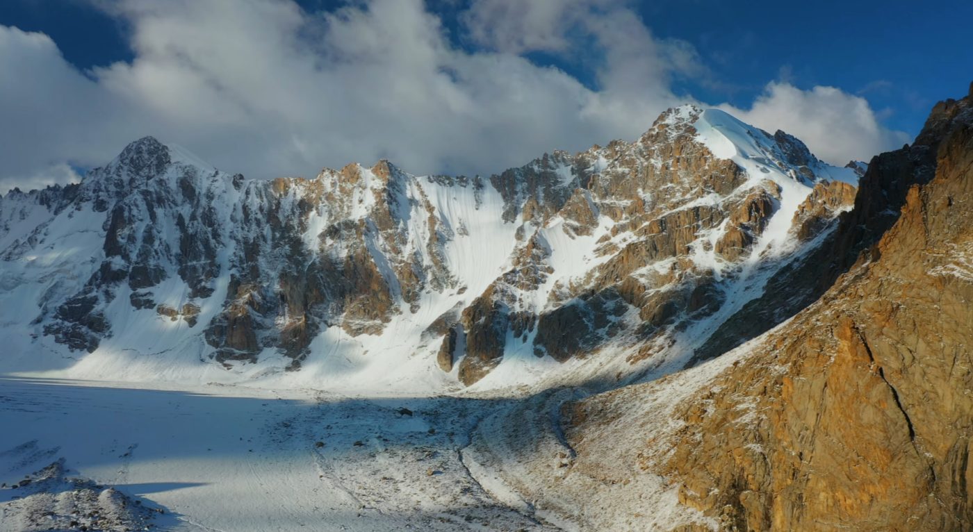
Glaciers in Kyrgyzstan are not only geological features — they are also vital water sources for the region. Many major rivers originate in high mountain glacier basins before flowing into the valleys of Central Asia.
- The Naryn River, one of the main tributaries of the Syr Darya, originates in glacier-fed basins of the Tian Shan.
- Several rivers flowing toward the Fergana Valley also begin in glacier systems of the central mountains.
- Glacier meltwater plays an important role in agriculture and hydropower across the region.
Research in the Chon Kyzyl-Suu subcatchment of the Issyk-Kul basin shows that glacier mass loss is already affecting the basin’s water balance, while groundwater processes also play a significant role in generating river discharge.
Because of this relationship between glaciers and river systems, the high mountains of Kyrgyzstan influence water resources far beyond the country’s borders.
Changing Glacier Landscapes
CAIAG’s national glacier inventory, based on Landsat 8 imagery from 2013–2016, identified 9,959 glaciers covering 6,683.9 km². The earlier Soviet catalogue, based on observations from the 1940s–1970s, recorded 8,164 glaciers covering 7,944.2 km². Despite the increase in the number of individually mapped glaciers, the total glacier-covered area had decreased by approximately 16%.
The number of individually mapped glaciers increased even as their total area declined. One reason is the fragmentation of larger glaciers into smaller glacier bodies. Of the 9,959 glaciers mapped in the inventory, 3,732 were smaller than 0.1 km², but together they accounted for only 189.9 km² of glacier-covered area. Glacier count alone should therefore not be interpreted as a measure of increasing glaciation.
Despite these changes, Kyrgyzstan remains one of the most glacier-rich parts of Central Asia. Large ice fields still dominate many high mountain valleys, particularly in the remote eastern Tian Shan where some of the country’s highest peaks are located.
Major Mountain Landscapes of Kyrgyzstan
While datasets and peak lists help explain the structure of Kyrgyzstan’s mountains, the country’s alpine geography is best understood through its landscapes. Mountain ranges, glacier systems, valleys, and high-elevation lakes combine to create some of the most dramatic scenery in Central Asia.
Several regions stand out for their scale and visual impact. These landscapes illustrate how the different mountain systems of Kyrgyzstan shape the country’s terrain and natural environments.
Issyk-Kul Mountain Basin
One of the most distinctive mountain landscapes in Kyrgyzstan surrounds Issyk-Kul, the country’s largest lake and one of the largest high-elevation lakes in the world. The basin lies between two major mountain ranges: the Kungey Ala-Too to the north and the Terskey Ala-Too to the south.
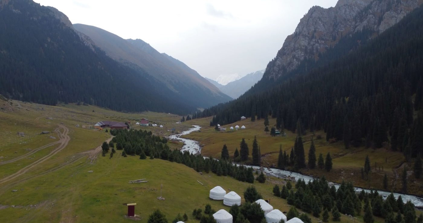
These mountains rise sharply above the lake, with many peaks exceeding 4,000 and even 5,000 meters. Snow-covered ridges and glacier valleys descend toward the shoreline, creating dramatic contrasts between alpine terrain and the deep blue waters of the lake.
The southern side of the basin near the town of Karakol is particularly well known for trekking routes, alpine lakes, and glacier valleys. Many travelers consider this region one of the most scenic parts of the entire Tian Shan.
Ala-Archa Mountains
Just south of the capital city of Bishkek lies the Ala-Archa National Park, one of the most accessible mountain landscapes in Kyrgyzstan. The park is located within the Kyrgyz Ala-Too Range, where steep ridges and glacier valleys rise directly above the Chuy Valley.
Several notable peaks dominate the skyline of this region, including Korona Peak, Uchitel Peak, and West Alamedin Peak. Because of its proximity to the capital, Ala-Archa has become a popular destination for climbers, hikers, and researchers studying the alpine ecosystems of the northern Tian Shan.
The valley itself is carved by the Ala-Archa River and surrounded by high granite walls and glacier basins. In winter the region becomes a center for mountaineering expeditions, while in summer alpine meadows attract hikers and nature enthusiasts.
Alay Valley and the Pamir-Alay Mountains
In southern Kyrgyzstan, the landscape changes dramatically in the Alay Valley. This wide valley lies between the Alay Range and the massive wall of the Trans-Alay Range, where some of the highest peaks in Central Asia rise above the plateau.
The most prominent summit here is Lenin Peak, which dominates the skyline at 7,134 meters. The mountain’s snow-covered slopes are visible from across the valley and form one of the most iconic mountain views in the region.
The Alay Valley itself sits at elevations above 3,000 meters, creating an expansive high-elevation landscape surrounded by towering mountains. This dramatic combination of open plateau and high peaks is characteristic of the transition between the Tian Shan and the Pamir mountain systems.
Laylak and Karavshin — the “Kyrgyz Patagonia”
In southwestern Kyrgyzstan, the Laylak and Karavshin gorges form one of the most important technical climbing areas of the Turkestan Range in Batken Region. The neighboring valleys lie on the northern side of the range and are known for large rock walls, striking rock towers and demanding alpine routes.
The area is sometimes called the “Kyrgyz Patagonia” in mountaineering literature because of the scale and character of its rock formations. Kyrgyz Alpine Club describes some walls here as reaching around 2,000 meters, including the north face of Ak-Suu. Pyramidalny Peak (5,509 m) is identified in mountaineering references as the highest peak of the Laylak–Karavshin climbing region.
Unlike more accessible mountain areas around Issyk-Kul and Ala-Archa, Laylak and Karavshin are primarily associated with technical mountaineering and big-wall climbing. They form one of Kyrgyzstan’s major climbing regions within the Pamir-Alay mountain system.
Central Tian Shan Glacier Region
Perhaps the most remote and extreme mountain landscapes of Kyrgyzstan are found in the Central Tian Shan. This region contains the highest peaks of the country along with extensive glacier systems such as the Engilchek glaciers.
Here the terrain becomes truly alpine. Massive ridges rise above glacier fields, and many valleys remain inaccessible except by helicopter or long expedition routes. Peaks such as Jengish Chokusu and Khan Tengri dominate the skyline, forming some of the most dramatic high mountain scenery anywhere in Central Asia.
Because of its extreme elevation and harsh weather conditions, the central Tian Shan remains one of the least populated and least explored regions of Kyrgyzstan. At the same time, it represents the heart of the country’s alpine geography.
Mountain Ecosystems of Kyrgyzstan
The mountains of Kyrgyzstan contain a remarkable range of ecosystems shaped primarily by elevation and climate. As elevation increases, landscapes transition through several distinct environmental zones. These zones support different plant communities, wildlife species, and alpine environments.
In lower valleys and foothills, steppe vegetation dominates the landscape. These areas support agriculture and human settlement and are often the most densely populated parts of the country.
At elevations between roughly 1,800 and 2,800 meters, mountain forests appear, particularly in the northern Tian Shan. These forests include spruce, juniper, and other conifer species that form important habitats for wildlife and help stabilize mountain soils.
Above the forest line, the terrain gradually transitions into alpine meadows. During the summer months these high pastures become covered with grasses and wildflowers. Traditionally, many Kyrgyz families bring livestock to these high mountain pastures, known locally as jailoo, for seasonal grazing.
Satellite-based research on mountain pastures in Kyrgyzstan shows how strongly these landscapes are controlled by local terrain and snow conditions. In a study covering five highland districts, elevation and the timing of seasonal snow cover explained much of the variation in early-season pasture development, while large-scale climate oscillations added relatively little predictive power at local scale.
At higher elevations, vegetation becomes sparse as rocky slopes and glacier fields dominate the terrain. These high-elevation environments are shaped by extreme temperatures, strong winds, and persistent snow cover.
Elevation Zones in the Kyrgyz Mountains
| Elevation | Typical Landscape |
|---|---|
| 800 – 1,800 m | Steppe and valley ecosystems |
| 1,800 – 2,800 m | Mountain forests |
| 2,800 – 3,500 m | Alpine meadows and high pastures |
| 3,500 – 4,500 m | Rocky alpine terrain |
| Above 4,500 m | Permanent snowfields and glaciers |
Wildlife of the Kyrgyz Mountains
The mountain ecosystems of Kyrgyzstan support a wide range of wildlife species adapted to life in high-altitude environments. Many of these animals inhabit remote mountain valleys and rocky slopes far from human settlements.
One of the most famous animals of the region is the snow leopard. This elusive predator lives in remote mountain terrain across the Tian Shan and Pamir-Alay systems. Although sightings are rare, Kyrgyzstan remains one of the important habitats for this endangered species.
Several large herbivores also inhabit the mountain ranges. The Siberian ibex is commonly found on steep alpine slopes, while the impressive Marco Polo sheep inhabits high plateau regions of the Pamir-Alay mountains.
Birdlife is also diverse. Golden eagles, lammergeiers, and other large birds of prey frequently soar above mountain valleys. These birds play an important ecological role and have long been associated with traditional Kyrgyz eagle hunting practices.
- Snow leopard
- Siberian ibex
- Marco Polo sheep
- Golden eagle
- Lammergeier (bearded vulture)
Why Kyrgyzstan Is One of the Most Mountainous Countries in the World
Few countries are defined by mountains as strongly as Kyrgyzstan. Current Kyrgyz government sources describe about 94 percent of the national territory as mountainous, while the World Bank reported 90 percent in 2025.
The presence of both the Tian Shan and Pamir-Alay mountain systems creates a landscape of extraordinary diversity. Massive ridgelines, glacier systems, alpine lakes, and high valleys combine to form a complex network of mountain environments across the country.
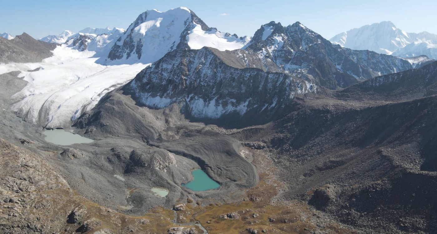
These mountains influence nearly every aspect of Kyrgyzstan’s geography. Rivers originate in glacier basins high in the Tian Shan, valleys shape settlement patterns, and alpine pastures remain central to traditional nomadic culture.
For researchers, climbers, and travelers, Kyrgyzstan represents one of the most fascinating mountain regions in Eurasia. The country’s peaks, glaciers, and remote highlands continue to attract exploration and scientific study while preserving some of the most dramatic alpine landscapes in the world.
Mountain Geography of Kyrgyzstan — Reference Summary
The following table summarizes key geographic indicators used in KMGD v2. Source-dependent alternatives are retained in the dataset provenance rather than blended into a single unsupported figure.
| Geographic Feature | Reference Value |
|---|---|
| Total area of Kyrgyzstan | ~199,900 km² (current Kyrgyz government reference) |
| Territory described as mountainous | ~94% in current Kyrgyz government sources; World Bank 2025 reports 90% |
| Territory above 1,000 m | 94.2% |
| Territory above 1,500 m | ~90% |
| Territory above 3,000 m | 40.8% |
| Average elevation | 2,750 m |
| Highest mountain | Jengish Chokusu — 7,439 m |
| Peaks above 7,000 m by rock elevation | 2 (3 reaching 7,000 m when the Khan Tengri ice cap is included) |
| Glaciers | 9,959 mapped in the 2013–2016 CAIAG inventory |
| Glacier-covered area | 6,683.9 km² in the 2013–2016 CAIAG inventory |
| Glacier area change | ~15.9% decrease from the Soviet catalogue baseline to the 2013–2016 inventory |
| Main mountain systems | Tian Shan; Pamir-Alay |
Plan a Mountain Trip in Kyrgyzstan
- Best time to visit Kyrgyzstan
- Ala Archa tours from Bishkek
- Karakol travel guide
- Ala-Kul Lake guide
- Altyn Arashan guide
- Song-Kul tour guide
- Kel-Suu Lake guide
- Horse riding tours in Kyrgyzstan
- Lakes of Kyrgyzstan
Kyrgyzstan Mountains FAQ
What percentage of Kyrgyzstan is mountains?
Current Kyrgyz government sources describe about 94% of Kyrgyzstan as mountainous, while the World Bank reported 90% in 2025. This is a classification-based estimate and should not be confused with elevation-threshold statistics: 94.2% of the country lies above 1,000 meters and about 90% lies above 1,500 meters.
What is the highest mountain in Kyrgyzstan?
The highest mountain in Kyrgyzstan is Jengish Chokusu, also known as Pobeda Peak or Victory Peak. It reaches 7,439 meters in the Tian Shan mountain system.
What is the main mountain range in Kyrgyzstan?
The main mountain system in Kyrgyzstan is the Tian Shan. The Pamir-Alay is the second major mountain system represented in the country, while the Trans-Alay Range is one of its most prominent southern ranges.
Are the mountains in Kyrgyzstan part of the Himalayas?
No. Kyrgyzstan’s mountains are part of the Tian Shan and Pamir-Alay systems, not the Himalayas.
Where should travelers go to see mountains in Kyrgyzstan?
For most travelers, the best mountain areas are Ala Archa near Bishkek, Karakol and Altyn Arashan near Issyk-Kul, Song-Kul for yurt stays, Kel-Suu for remote scenery, and the Alay Valley for Pamir-Alay views.
Sources and Data
This guide combines official Kyrgyz geographic statistics with peer-reviewed glaciological research and international geographic reference sources. Because mountain elevations, glacier dimensions and regional classifications may differ between surveys and measurement dates, figures are presented as reference values rather than absolute constants. The downloadable KMGD v2 package provides the complete source registry and field-level provenance behind the core peak, mountain-unit, glacier, and indicator data.
- National Statistical Committee of the Kyrgyz Republic — national geographic and environmental statistics, including the share of Kyrgyzstan lying above 1,500 meters.
- Department of Tourism of the Kyrgyz Republic — official geographic overview of Kyrgyzstan, including national mountain-terrain statistics and major summit elevations.
- National Investment Agency under the President of the Kyrgyz Republic — current government reference for national territory (~199.9 thousand km²) and the description of about 94% of Kyrgyzstan as mountainous.
- Kyrgyzstan Geography: Encyclopedic Textbook (2004) — state geographic reference used for the morphometry and maximum elevations of multiple Kyrgyz mountain ranges.
- World Bank, “Towards Understanding Regional Development Dynamics in the Kyrgyz Republic” (2025) — national geography and the commonly cited estimate that roughly 90% of Kyrgyzstan is mountainous.
- Tomaszewska & Henebry (2020), International Journal of Applied Earth Observation and Geoinformation — satellite-based research on mountain pastures in Kyrgyzstan, showing the importance of elevation, terrain and snow-cover timing in shaping local vegetation dynamics.
- Central Asian Institute for Applied Geosciences (CAIAG), World Day for Glaciers (2026) — current reference information on Kyrgyzstan’s largest glaciers, including Southern Engilchek, Northern Engilchek and Kaindy.
- Shabunin A.G., Catalogue of Glaciers of Kyrgyzstan (CAIAG, 2018; Edition 01/2024) — national glacier inventory based on Landsat 8 imagery from 2013–2016, documenting 9,959 glaciers with a total area of 6,683.9 km² and comparing modern glacier coverage with the earlier Soviet glacier catalogue.
- Chevallier et al. (2023), Science of the Total Environment — hydrological modelling of the Chon Kyzyl-Suu subcatchment of the Issyk-Kul basin, including glacier mass loss, glacier runoff and groundwater contributions to river discharge.
- Van Tricht et al. (2021), Frontiers in Earth Science — historical mass-balance reconstruction and modern measurements for Bordu, Kara-Batkak and Sary-Tor glaciers in the Inner Tian Shan.
- Van Tricht & Huybrechts (2022), The Cryosphere — glaciological measurements and research on Sary-Tor Glacier and the Grigoriev ice cap in the Inner Tian Shan.
- Mattea et al. (2025), The Cryosphere — five decades of Abramov Glacier dynamics reconstructed with multi-sensor optical remote sensing.
- Engel, Šobr & Yerokhin, Journal of Glaciology — research on Petrov Glacier and its proglacial lake in the Ak-Shyrak massif.
- Gilligan, Roecker, Priestley & Nunn (2014), Geophysical Journal International — seismic structure of the Kyrgyz Tian Shan, including evidence for Tarim Basin underthrusting beneath the southern Tian Shan and unusually thick crust beneath the Kokshaal Range.
- UNESCO Man and the Biosphere Programme — geographic and ecological reference information for the Issyk-Kul mountain region.
- UNESCO World Heritage Centre — reference information on the Western Tian Shan mountain landscapes and ecosystems.
- Kyrgyz Alpine Club, “Mountaineering Regions of Kyrgyzstan” — reference information on the Laylak and Karavshin climbing region of the Turkestan Range, including major peaks, rock-wall characteristics and the “Kyrgyz Patagonia” designation.
- American Alpine Journal — expedition reports and climbing records from Kyrgyzstan, including the Laylak and Karavshin regions and the Fergana Range, with references to Ak-Suu, Pyramidalny and Uch-Seit.
Peak elevations and mountain-range classifications were cross-checked across multiple geographic and mountaineering references. Border peaks, glacier dimensions and the boundaries of regional mountain divisions may be reported differently between sources.
How to Cite This Page
Researchers, students, and writers referencing the geographic data presented in this article may cite it as follows:
Kyrgyzstan Planner. “Mountains of Kyrgyzstan: Geography, Highest Peaks, Mountain Ranges, and Glaciers.” KyrgyzstanPlanner.com, 2026.
URL: https://kyrgyzstanplanner.com/mountains-of-kyrgyzstan/